sp@itia.ntua.gr
+30 210 772 2838
Flood risk estimation and forecast using hydrological models and probabilistic methods
Duration: February 2007–August 2008
Budget: €15 000
Commissioned by: National Technical University of Athens
Contractor: Department of Water Resources and Environmental Engineering
Collaborators: Hydrologic Research Center
Project director: D. Koutsoyiannis
Principal investigator: S.M. Papalexiou
Programme: Πρόγραμμα Βασικής Έρευνας ΕΜΠ "Κωνσταντίνος Καραθεοδωρή"
The objective of this project is the development of an integrated framework for the estimation and forecast of flood risk using stochastic, hydrological and hydraulics methods. The study area is the Boeticos Kephisos river basin. The project includes analysis of severe storm episodes in the basin, the understanding of mechanisms of flood generation in this karstic basin and the estimation of flood risk in characteristic sites of the hydrosystem.
Σχέδιο Διαχείρισης Κινδύνων Πλημμύρας των Λεκανών Απορροής Ποταμών του Υδατικού Διαμερίσματος Δυτικής Πελοποννήσου (GR01)
Commissioned by: Specific Secreteriat of Water
Contractor: ADT-OMEGA
Σχέδιο Διαχείρισης Κινδύνων Πλημμύρας των Λεκανών Απορροής Ποταμών του Υδατικού Διαμερίσματος Βόρειας Πελοποννήσου (GR02)
Commissioned by: Specific Secreteriat of Water
Contractor: ADT-OMEGA
Σχέδιο Διαχείρισης Κινδύνων Πλημμύρας των Λεκανών Απορροής Ποταμών του Υδατικού Διαμερίσματος Ανατολικής Πελοποννήσου (GR03)
Commissioned by: Specific Secreteriat of Water
Contractor: ADT-OMEGA
Σχέδιο Διαχείρισης Κινδύνων Πλημμύρας των Λεκανών Απορροής Ποταμών του Υδατικού Διαμερίσματος Κρήτης (GR13)
Commissioned by: Specific Secreteriat of Water
Contractor: ADT-OMEGA
Study of the management of Kephisos
Duration: June 2009–April 2010
Commissioned by: General Secretariat of Public Works
Contractors:
I. Tsoukalas, S.M. Papalexiou, A. Efstratiadis, and C. Makropoulos, A cautionary note on the reproduction of dependencies through linear stochastic models with non-Gaussian white noise, Water, 10 (6), 771, doi:10.3390/w10060771, 2018.
Since the prime days of stochastic hydrology back in 1960s, autoregressive (AR) and moving average (MA) models (as well as their extensions) have been widely used to simulate hydrometeorological processes. Initially, AR(1) or Markovian models with Gaussian noise prevailed due to their conceptual and mathematical simplicity. However, the ubiquitous skewed behavior of most hydrometeorological processes, particularly at fine time scales, necessitated the generation of synthetic time series to also reproduce higher-order moments. In this respect, the former schemes were enhanced to preserve skewness through the use of non-Gaussian white noise— a modification attributed to Thomas and Fiering (TF). Although preserving higher-order moments to approximate a distribution is a limited and potentially risky solution, the TF approach has become a common choice in operational practice. In this study, almost half a century after its introduction, we reveal an important flaw that spans over all popular linear stochastic models that employ non-Gaussian white noise. Focusing on the Markovian case, we prove mathematically that this generating scheme provides bounded dependence patterns, which are both unrealistic and inconsistent with the observed data. This so-called “envelope behavior” is amplified as the skewness and correlation increases, as demonstrated on the basis of real-world and hypothetical simulation examples.
Full text: http://www.itia.ntua.gr/en/getfile/1848/1/documents/water-10-00771.pdf (14101 KB)
See also: http://www.mdpi.com/2073-4441/10/6/771
Other works that reference this work (this list might be obsolete):
| 1. | Papalexiou, S. M., Y. Markonis, F. Lombardo, A. AghaKouchak, and E. Foufoula‐Georgiou, Precise temporal Disaggregation Preserving Marginals and Correlations (DiPMaC) for stationary and non‐stationary processes, Water Resources Research, 54(10), 7435-7458, doi:10.1029/2018WR022726, 2018. |
| 2. | Cheng, Y., P. Feng, J. Li, Y. Guo, and P. Ren, Water supply risk analysis based on runoff sequence simulation with change point under changing environment, Advances in Meteorology, 9619254, doi:10.1155/2019/9619254, 2019. |
| 3. | Marković, D., S. Ilić, D. Pavlović, J. Plavšić, and N. Ilich, Multivariate and multi-scale generator based on non-parametric stochastic algorithms, Journal of Hydroinformatics, 21(6), 1102–1117, doi:10.2166/hydro.2019.071, 2019. |
| 4. | Nazemi, A., M. Zaerpour, and E. Hassanzadeh, Uncertainty in bottom-up vulnerability assessments of water supply systems due to regional streamflow generation under changing conditions, Journal of Water Resources Planning and Management, 146(2), doi:10.1061/(ASCE)WR.1943-5452.0001149, 2020. |
| 5. | Wang, Q., J. Zhou, K. Huang, L. Dai, B. Jia, L. Chen, and H. Qin, A procedure for combining improved correlated sampling methods and a resampling strategy to generate a multi-site conditioned streamflow process, Water Resources Management, 35, 1011-1027, doi:10.1007/s11269-021-02769-8, 2021. |
| 6. | Zounemat-Kermani, M., A. Mahdavi-Meymand, and A. Hinkelmann, A comprehensive survey on conventional and modern neural networks: application to river flow forecasting, Earth Science Informatics, 14, 893-911, doi:10.1007/s12145-021-00599-1, 2021. |
| 7. | Pouliasis, G., G. A. Torres-Alves, and O. Morales-Napoles, Stochastic modeling of hydroclimatic processes using vine copulas, Water, 13(16), 2156, doi:10.3390/w13162156, 2021. |
| 8. | Jia, B., J. Zhou, Z. Tang, Z. Xu, X. Chen, and W. Fang, Effective stochastic streamflow simulation method based on Gaussian mixture model, Journal of Hydrology, 605, 127366, doi:10.1016/j.jhydrol.2021.127366, 2022. |
| 9. | Crespo, D., T. Kahil, J. Albiac, F. Gaupp, and E. Esteban, Assessment of drought impacts in the Ebro basin using hydro-economic modeling and copula-based water availability simulations, Water Economics and Policy, doi:10.1142/S2382624X25400041, 2025. |
G. Papaioannou, A. Efstratiadis, L. Vasiliades, A. Loukas, S.M. Papalexiou, A. Koukouvinos, I. Tsoukalas, and P. Kossieris, An operational method for Floods Directive implementation in ungauged urban areas, Hydrology, 5 (2), 24, doi:10.3390/hydrology5020024, 2018.
An operational framework for flood risk assessment in ungauged urban areas is developed within the implementation of the EU Floods Directive in Greece, and demonstrated for Volos metropolitan area, central Greece, which is frequently affected by intense storms causing fluvial flash floods. A scenario-based approach is applied, accounting for uncertainties of key modeling aspects. This comprises extreme rainfall analysis, resulting to spatially-distributed Intensity-Duration-Frequency (IDF) relationships and their confidence intervals, and flood simulations, through the SCS-CN method and the unit hydrograph theory, producing design hydrographs at the sub-watershed scale, for several soil moisture conditions. The propagation of flood hydrographs and the mapping of inundated areas are employed by the HEC-RAS 2D model, with flexible mesh size, by representing the resistance caused by buildings through the local elevation rise method. For all hydrographs, upper and lower estimates on water depths, flow velocities and inundation areas are estimated, for varying roughness coefficient values. The methodology is validated against the flood event of the 9th October 2006, using observed flood inundation data. Our analyses indicate that although typical engineering practices for ungauged basins are subject to major uncertainties, the hydrological experience may counterbalance the missing information, thus ensuring quite realistic outcomes.
Remarks:
This article won the Hydrology Best Paper Award for 2020 (https://www.mdpi.com/journal/hydrology/awards/850)
Full text: http://www.itia.ntua.gr/en/getfile/1829/1/documents/hydrology-05-00024_Idnk8fW.pdf (5243 KB)
Additional material:
Other works that reference this work (this list might be obsolete):
| 1. | Petroselli, A., M. Vojtek, and J. Vojteková, Flood mapping in small ungauged basins: A comparison of different approaches for two case studies in Slovakia, Hydrology Research, 50(1), 379-392, doi:10.2166/nh.2018.040, 2018. |
| 2. | Manfreda, S., C. Samela, A. Refice, V. Tramutoli, and F. Nardi, Advances in large-scale flood monitoring and detection, Hydrology, 5(3), 49, doi:10.3390/hydrology5030049, 2018. |
| 3. | Doroszkiewicz, J., R. J. Romanowicz, and A. Kiczko, The influence of flow projection errors on flood hazard estimates in future climate conditions, Water, 11(1), 49, doi:10.3390/w11010049, 2019. |
| 4. | Enigl, K., C. Matulla, M. Schlögla, and F. Schmid, Derivation of canonical total-sequences triggering landslides and floodings in complex terrain, Advances in Water Resources, 129, 178-188, doi:10.1016/j.advwatres.2019.04.018, 2019. |
| 5. | Chen, N., S. Yao, C. Wang, and W. Du, A method for urban flood risk assessment and zoning considering road environments and terrain, Sustainability, 11(10), 2734, doi:10.3390/su11102734, 2019. |
| 6. | Jiang, X., L., Yang, and H. Tatano, Assessing spatial flood risk from multiple flood sources in a small river basin: A method based on multivariate design rainfall, Water, 11(5), 1031, doi:10.3390/w11051031, 2019. |
| 7. | Vojtek, M., A. Petroselli, J. Vojteková, and S. Asgharinia, Flood inundation mapping in small and ungauged basins: sensitivity analysis using the EBA4SUB and HEC-RAS modeling approach, Hydrology Research, 50(4), 1002-1019, doi:10.2166/nh.2019.163, 2019. |
| 8. | Lorenzo-Lacruz, J., C. Garcia, E. Morán-Tejeda, A. Amengual, V. Homar, A. Maimó-Far, A. Hermoso, C. Ramis, and R. Romero, Hydro-meteorological reconstruction and geomorphological impact assessment of the October, 2018 catastrophic flash flood at Sant Llorenç, Mallorca (Spain), Natural Hazards and Earth System Sciences, 19(11), 2597-2617, doi:10.5194/nhess-19-2597-2019, 2019. |
| 9. | Hamdan, A. N. A., A. A. Abbas, and A. T. Najm, Flood hazard analysis of proposed regulator on Shatt Al-Arab river, Hydrology, 6(3), 80, doi:0.3390/hydrology6030080, 2019. |
| 10. | Deby, R., V. Dermawan, and D. Sisinggih, Analysis of Wanggu river flood inundation Kendari City Southeast Sulawesi province using HEC RAS 5.0.6, International Research Journal of Advanced Engineering and Science, 4(2), 270-275, 2019. |
| 11. | Rauter, M., T. Thaler, M.-S. Attems, and S. Fuchs, Obligation or innovation: Can the EU Floods Directive Be seen as a tipping point towards more resilient flood risk management? A case study from Vorarlberg, Austria, Sustainability, 11, 5505, doi:10.3390/su11195505, 2019. |
| 12. | Papaioannou, G., G. Varlas, G. Terti, A. Papadopoulos, A. Loukas, Y. Panagopoulos, and E. Dimitriou, Flood inundation mapping at ungauged basins using coupled hydrometeorological-hydraulic modelling: The catastrophic case of the 2006 flash flood in Volos City, Greece, Water, 11, 2328, doi:10.3390/w11112328, 2019. |
| 13. | Rahmati, O., H. Darabi, A. T. Haghighi, S. Stefanidis, A. Kornejady, O. A. Nalivan, and D. T. Bui, Urban flood hazard modeling using self-organizing map neural network, Water, 11(11), 2370, doi:10.3390/w11112370, 2019. |
| 14. | Dano, U. L., A.-L. Balogun, A.-N. Matori,K. Wan Yusouf, I. R. Abubakar, M. A. Said Mohamed, , Y.A. Aina, and B. Pradhan, Flood susceptibility mapping using an improved analytic network process with statistical models, Water, 11(3), 615, doi:10.3390/w11030615, 2019. |
| 15. | Petroselli, A., S. Grimaldi, R. Piscopia, and F. Tauro, Design hydrograph estimation in small and ungauged basins: a comparative assessment of event based (EBA4SUB) and continuous (COSMO4SUB) modeling approaches, Acta Scientiarum Polonorum Formatio Circumiectus, 18(4), 113-124, doi:10.15576/ASP.FC/2019.18.4.113, 2019. |
| 16. | Nguyen, V.-N., P. Yariyan, M. Amiri, A. Dang Tran, T.D. Pham, M.P. Do, P. T. Thi Ngo, V.-H. Nhu, N. Quoc Long, and D. Tien Bui, A new modeling approach for spatial prediction of flash flood with biogeography optimized CHAID tree ensemble and remote sensing data, Remote Sensing, 12(9), 1373, doi:10.3390/rs12091373, 2020. |
| 17. | Kastridis, A., and D. Stathis, Evaluation of hydrological and hydraulic models applied in typical Mediterranean ungauged watersheds using post-flash-flood measurements, Hydrology, 7(1), 12, doi:10.3390/hydrology7010012, 2020. |
| 18. | Stavropoulos, S., G. N. Zaimes, E. Filippidis, D. C. Diaconu, and D. Emmanouloudis, Mitigating flash floods with the use of new technologies: A multi-criteria decision analysis to map flood susceptibility for Zakynthos island, Greece, Journal of Urban & Regional Analysis, 12(2), 233-248, 2020. |
| 19. | Kastridis, A., C. Kirkenidis, and M. Sapountzis, An integrated approach of flash flood analysis in ungauged Mediterranean watersheds using post‐flood surveys and Unmanned Aerial Vehicles (UAVs), Hydrological Processes, 34(25), 4920-4939, doi:10.1002/hyp.13913, 2020. |
| 20. | Abdrabo, K. I., S. A. Kantoush, M. Saber, T. Sumi, O. M. Habiba, D. Elleithy, and B. Elboshy, Integrated methodology for urban flood risk mapping at the microscale in ungauged regions: A case study of Hurghada, Egypt, Remote Sensing, 12(21), 3548, doi:10.3390/rs12213548, 2020. |
| 21. | Yariyan, P., M. Avand, R. A. Abbaspour, A. T. Haghighi, R. Costache, O. Ghorbanzadeh, S. Janizadeh, and T. Blaschke, Flood susceptibility mapping using an improved analytic network process with statistical models, Geomatics, Natural Hazards and Risk, 11(1), 2282-2314, doi:10.1080/19475705.2020.1836036, 2020. |
| 22. | Papaioannou, G., C. Papadaki, and E. Dimitriou, Sensitivity of habitat hydraulic model outputs to DTM and computational mesh resolution, Ecohydrology, 13(2), e2182, doi:10.1002/eco.2182, 2020. |
| 23. | Papaioannou, G., G. Varlas, A. Papadopoulos, A. Loukas, P. Katsafados, and E. Dimitriou, Investigating sea‐state effects on flash flood hydrograph and inundation forecasting, Hydrological Processes, 35(4), e14151, doi:10.1002/hyp.14151, 2021. |
| 24. | Mahamat Nour, A., C. Vallet‐Coulomb, J. Gonçalves, F. Sylvestre, and P. Deschamps, Rainfall-discharge relationship and water balance over the past 60 years within the Chari-Logone sub-basins, Lake Chad basin, Journal of Hydrology: Regional Studies, 35, 100824, doi:10.1016/j.ejrh.2021.100824, 2021. |
| 25. | Varlas, G., A. Papadopoulos, G. Papaioannou, and E. Dimitriou, Evaluating the forecast skill of a hydrometeorological modelling system in Greece, Atmosphere, 12(7), 902, doi:10.3390/atmos12070902, 2021. |
| 26. | Khalaj, M. R., H. Noor, and A. Dastranj, Investigation and simulation of flood inundation hazard in urban areas in Iran, Geoenvironmental Disasters, 8, 18, doi:10.1186/s40677-021-00191-1, 2021. |
| 27. | Hooke, J., J. Souza, and M. Marchamalo, Evaluation of connectivity indices applied to a Mediterranean agricultural catchment, Catena, 207, 105713, doi:10.1016/j.catena.2021.105713, 2021. |
| 28. | Seleem, O., M. Heistermann, and A. Bronstert, Efficient hazard assessment for pluvial floods in urban environments: A benchmarking case study for the city of Berlin, Germany, Water, 13(18), 2476, doi:10.3390/w13182476, 2021. |
| 29. | Cotugno, A., V. Smith, T. Baker, and R. Srinivasan, A framework for calculating peak discharge and flood inundation in ungauged urban watersheds using remotely sensed precipitation data: A case study in Freetown, Sierra Leone, Remote Sensing, 13(19), 3806, doi:10.3390/rs13193806, 2021. |
| 30. | Berteni, F., A. Dada, and G. Grossi, Application of the MUSLE model and potential effects of climate change in a small Alpine catchment in Northern Italy, Water, 13(19), 2679, doi:10.3390/w13192679, 2021. |
| 31. | Kastridis, A., G. Theodosiou, and G. Fotiadis, Investigation of flood management and mitigation measures in ungauged NATURA protected watersheds, Hydrology, 8(4), 170, doi:10.3390/hydrology8040170, 2021. |
| 32. | Ali, A. A., and H. A. Al Thamiry, H. A., Controlling the salt wedge intrusion in Shatt Al-Arab river by a barrage, Journal of Engineering, 27(12), 69-86, doi:10.31026/j.eng.2021.12.06, 2021. |
| 33. | Alamanos, A., P. Koundouri, L. Papadaki, and T. Pliakou, A system innovation approach for science-stakeholder interface: theory and application to water-land-food-energy nexus, Frontiers in Water, 3, 744773, doi:10.3389/frwa.2021.744773, 2022. |
| 34. | Papaioannou, G., V. Markogianni, A. Loukas, and E. Dimitriou, Remote sensing methodology for roughness estimation in ungauged streams for different hydraulic/hydrodynamic modeling approaches, Water, 14(7), 1076, doi:10.3390/w14071076, 2022. |
| 35. | Jessie, L., O. Brivois, P. Mouillon, A. Maspataud, P. Belz, and J.-M. Laloue, Coastal flood modeling to explore adaptive coastal management scenarios and land-use changes under sea level rise, Frontiers in Marine Science, 9, 710086, doi:10.3389/fmars.2022.710086, 2022. |
| 36. | Tegos, A., A. Ziogas, V. Bellos, and A. Tzimas, Forensic hydrology: a complete reconstruction of an extreme flood event in data-scarce area, Hydrology, 9(5), 93, doi:10.3390/hydrology9050093, 2022. |
| 37. | Neves, J. L., T. K. Sellick, A. Hasan, and P. Pilesjö, Flood risk assessment under population growth and urban land use change in Matola, Mozambique, African Geographical Review, doi:10.1080/19376812.2022.2076133, 2022. |
| 38. | Khosh Bin Ghomash, S., D. Bachmann, D. Caviedes-Voullième, and C. Hinz, Impact of rainfall movement on flash flood response: A synthetic study of a semi-arid mountainous catchment, Water, 14(12), 1844, doi:10.3390/w14121844, 2022. |
| 39. | Arnsteg, A., J. Glinski, P. Marijauskaite, A. Nitschke, M. Olsson, A. Pierre, L. Rosenquist Ohlsson, S. van der Vleuten, and P. Pilesjö, Flood modelling and proposed Blue-Green Solutions – A case study in Lisbon, Portugal, AGILE: GIScience Series, 3, 53, doi:10.5194/agile-giss-3-53-2022, 2022. |
| 40. | Yavuz, C., K. Yilmaz, and G. Onder, Combined hazard analysis of flood and tsunamis on the western Mediterranean coast of Turkey, Nat. Hazards Earth Syst. Sci. Discuss., doi:10.5194/nhess-2022-121, 2022. |
| 41. | Giannaros, C., S. Dafis, S. Stefanidis, T. M. Giannaros, I. Koletsis, and C. Oikonomou, Hydrometeorological analysis of a flash flood event in an ungauged Mediterranean watershed under an operational forecasting and monitoring context, Meteorological Applications, 29(4), e2079, doi:10.1002/met.2079, 2022. |
| 42. | Koutalakis, P., and G. N. Zaimes, River flow measurements utilizing UAV-based surface velocimetry and bathymetry coupled with sonar, Hydrology, 9(8), 148, doi:10.3390/hydrology9080148, 2022. |
| 43. | #Yassine, R., M. Lastes, A. Argence, A. Gandouin, C. Imperatrice, P. Michel, R. Zhang, P. Brigode, O. Delestre, and F. Taccone, Simulation of the Alex storm flash-flood in the Vésubie catchment (South Eastern France) using Telemac-2D hydraulic code, Advances in Hydroinformatics, Gourbesville, P., Caignaert, G. (eds.), Springer Water, Springer, Singapore, doi:10.1007/978-981-19-1600-7_52, 2022. |
| 44. | Donnelly, J., S. Abolfathi, J. Pearson, O. Chatrabgoun, and A. Daneshkhah, Gaussian process emulation of spatio-temporal outputs of a 2D inland flood model, Water Research, 225, 119100, doi:10.1016/j.watres.2022.119100, 2022. |
| 45. | Alamanos, A., P. Koundouri, L. Papadaki, T. Pliakou, and E. Toli, Water for tomorrow: A living lab on the creation of the science-policy-stakeholder interface, Water, 14(18), 2879, doi:10.3390/w14182879, 2022. |
| 46. | #Alves, R., J. C. Branco, and J. S. Baptista, Flood risk assessment and emergency planning – A short review, Occupational and Environmental Safety and Health IV, Studies in Systems, Decision and Control, 449, 615-629, Springer, Cham, doi:10.1007/978-3-031-12547-8_49, 2023. |
| 47. | Alarifi, S. S., M. Abdelkareem, F. Abdalla, and M. Alotaibi, Flash flood hazard mapping using remote sensing and GIS techniques in Southwestern Saudi Arabia, Sustainability, 14(21), 14145, doi:10.3390/su142114145, 2022. |
| 48. | Yavuz, C., K. Yilmaz, K., and G. Onder, Multi-hazard analysis of flood and tsunamis on the western Mediterranean coast of Turkey, Natural Hazards and Earth System Sciences, 22, 3725-3736, doi:10.5194/nhess-22-3725-2022, 2022. |
| 49. | Rusinko, A., and S. Horáčková, Flash flood simulation in the urbanised catchment: Aa case study of Bratislava-Karlova Ves, Geographia Cassoviensis, 16(2), 81-97, doi:10.33542/GC2022-2-01, 2022. |
| 50. | #Vasiliades, L., E. Farsirotou, and A. Psilovikos, An integrated hydrologic/hydraulic analysis of the Medicane "Ianos" flood event in Kalentzis River Basin, Greece, Proceedings of 7th IAHR Europe Congress "Innovative Water Management in a Changing Climate”, 235-236, Athens, International Association for Hydro-Environment Engineering and Research (IAHR), 2022. |
| 51. | Efe, H., and F. Önen, Failure analysis of Batman Dam and evaluation in terms of dam safety, Dicle University Journal of Engineering, 13(3), 579-587, doi:10.24012/dumf.1097025, 2022. |
| 52. | Adnan, M. S. G. , Z. S. Siam, I. Kabir, Z. Kabir, M. R. Ahmed, Q. K. Hassan, R. M. Rahman, and A. Dewan, A novel framework for addressing uncertainties in machine learning-based geospatial approaches for flood prediction, Journal of Environmental Management, 326(B), 116813, doi:10.1016/j.jenvman.2022.116813, 2023. |
| 53. | Cahyono, A. B., and A. B. Hak, Flood inundation simulation using HEC-GeoRAS with hydro-enforced-DTM LiDAR data, IOP Conference Series: Earth and Environmental Science, 1127, 012049, doi:10.1088/1755-1315/1127/1/012049, 2023. |
| 54. | Khosh Bin Ghomash, S., D. Bachmann, D. Caviedes-Voullième, and C Hinz, Effects of within-storm variability on allochthonous flash flooding: A synthetic study, Water, 15(4), 645, doi:10.3390/w15040645, 2023. |
| 55. | Yilmaz, K., Y. Darama, Y., Y. Oruc, and A. B. Melek, Assessment of flood hazards due to overtopping and piping in Dalaman Akköprü Dam, employing both shallow water flow and diffusive wave equations, Natural Hazards, 117, 979-1003, doi:10.1007/s11069-023-05891-5, 2023. |
| 56. | Mattas, C., D. Karpouzos, P. Georgiou, and T. Tsapanos, Two-dimensional modelling for dam break analysis and flood hazard mapping: A case study of Papadia Dam, Northern Greece, Water, 15(5), 994, doi:10.3390/w15050994, 2023. |
| 57. | Hughes, W., L. Santos, Q. Lu, R. Malla, N. Ravishanker, and W. Zhang, Probabilistic risk assessment framework for predicting large woody debris accumulations and scour near bridges, Structure and Infrastructure Engineering, doi:10.1080/15732479.2023.2177875, 2023. |
| 58. | Vasiliades, L., G. Papaioannou, and A. Loukas, A unified hydrologic framework for flood design estimation in ungauged basins, Environmental Sciences Proceedings, 25(1), 40, doi:10.3390/ECWS-7-14194, 2023. |
| 59. | Akkus, H., E. Yildiz, and I. Bulut, HEC-RAS 2B Modeli Kullanılarak Yazılıkaya Deresi (Nallıhan Ankara) Sel Tehlike Haritalarının Hazırlanması ve Sel Kontrol Yapısının Etkinliği, Jeoloji Muhendisligi Dergisi, 47(1), 29-46, doi:10.24232/jmd.1268945, 2023. |
| 60. | Le Gal, M., T. Fernández-Montblanc, E. Duo, J. Montes Perez, P. Cabrita, P. Souto Ceccon, V. Gastal, P. Ciavola, and C. Armaroli, A new European coastal flood database for low-medium intensity events, EGUsphere, doi:10.5194/egusphere-2023-1157, 2023. |
| 61. | Iliadis, C., P. Galiatsatou, V. Glenis, P. Prinos, and C. Kilsby, Urban flood modelling under extreme rainfall conditions for building-level flood exposure analysis, Hydrology, 10(8), 172, doi:10.3390/hydrology10080172, 2023. |
| 62. | Uysal, G., and E. Taşçı, Analysis of downstream flood risk in the failure of Batman Dam with two-dimensional hydraulic modeling and satellite data, Journal of Natural Hazards and Environment, 9(1), 39-57, doi:10.21324/dacd.1107630, 2023. |
| 63. | Kiesel, J., M. Lorenz, M. König, U. Gräwe, and A. T. Vafeidis, Regional assessment of extreme sea levels and associated coastal flooding along the German Baltic Sea coast, Natural Hazards and Earth System Sciences, 23, 2961-2985, doi:10.5194/nhess-23-2961-2023, 2023. |
| 64. | Çirağ, B., and M. Firat, Two-dimensional (2D) flood analysis and calibration of stormwater drainage systems using geographic information systems, Water Science & Technology, 87(10), 2577-2596, doi:10.2166/wst.2023.126, 2023. |
| 65. | Bouadila, A., I. Bouizrou, M. Aqnouy, K. En-nagre, Y. El Yousfi, A. Khafouri, I. Hilal, K. Abdelrahman, L. Benaabidate, T. Abu-Alam, J. E. S. El Messari, and M. Abioui, Streamflow simulation in semiarid data-scarce regions: A comparative study of distributed and lumped models at Aguenza watershed (Morocco), Water, 15(8), 1602, doi:10.3390/w15081602, 2023. |
| 66. | Kiesel, J., M. Lorenz, M. König, U. Gräwe, and A. T. Vafeidis, A new modelling framework for regional assessment of extreme sea levels and associated coastal flooding along the German Baltic Sea coast, Natural Hazards and Earth System Sciences, 23, 2961-2985, doi:10.5194/nhess-2022-275, 2023. |
| 67. | Baykal, T., S. Terzi, and E. D. Taylan, Examination of safe routes for emergency responders and people during urban flood: a case study of Isparta, Türkiye, Natural Hazards, doi:10.1007/s11069-023-06171-y, 2023. |
| 68. | Le Gal, M., T. Fernández-Montblanc, E. Duo, J. Montes Perez, P. Cabrita, P. Souto Ceccon, V. Gastal, P. Ciavola, and C. Armaroli, A new European coastal flood database for low–medium intensity events, Natural Hazards and Earth System Sciences, 23, 3585-3602, doi:10.5194/nhess-23-3585-2023, 2023. |
| 69. | Sfetsos, A., N. Politi, and D. Vlachogiannis, Multi-hazard extreme scenario quantification using intensity, duration, and return period characteristics, Climate, 11(12), 242, doi:10.3390/cli11120242, 2023. |
| 70. | Nistoran, D. E. G., C. S. Ionescu, and S. M. Simionescu, Assessing the impact of an arch-dam breach magnitude and reservoir inflow on flood maps, Journal of Hydroinformatics, doi:10.2166/hydro.2023.301, 2024. |
| 71. | #Sardar, F., M. H. Ali, I. Popescu, A. Jonoski, S. J. van Andel, and C. Bertini, Surface-subsurface interaction analysis and the influence of precipitation spatial variability on a lowland mesoscale catchment, Hydrol. Earth Syst. Sci. Discuss., doi:10.5194/hess-2023-276, 2023. |
| 72. | Aljber, M., H. S. Lee, J.-S. Jeong, and J. S. Cabrera, Tsunami inundation modelling in a built-in coastal environment with adaptive mesh refinement: The Onagawa benchmark test, Journal of Marine Science and Engineering, 12(1), 177, doi:10.3390/jmse12010177, 2024. |
| 73. | Kyaw, K. K., F. Bonaiuti, H. Wang, S. Bagli, P. Mazzoli, P. P. Alberoni, S. Persiano, and A. Castellarin, Fast-processing DEM-based urban and rural inundation scenarios from point-source flood volumes, Sustainability, 16(2), 875, doi:10.3390/su16020875, 2024. |
| 74. | Peker, İ. B., S. Gülbaz, V. Demir, O. Orhan, and N. Beden, Integration of HEC-RAS and HEC-HMS with GIS in flood modeling and flood hazard mapping, Sustainability, 16(3), 1226, doi:10.3390/su16031226, 2024. |
| 75. | Velegrakis, A. F., D. Chatzistratis, T. Chalazas, C. Armaroli, E. Schiavon, B. Alves, D. Grigoriadis, T. Hasiotis, and E. Ieronymidi, Earth observation technologies, policies and legislation for the coastal flood risk assessment and management: a European perspective, Anthropocene Coasts, 7(3), doi:10.1007/s44218-024-00037-x, 2024. |
| 76. | Alshammari, E., A. Abdul Rahman, R. Ranis, N. Abu Seri, and F. Ahmad, Investigation of runoff and flooding in urban areas based on hydrology models: A literature review, International Journal of Geoinformatics, 20(1), 99–119, doi:10.52939/ijg.v20i1.3033, 2024. |
| 77. | Gogoașe Nistoran, D. E., C. S. Ionescu, and S. M. Simionescu, Assessing the impact of an arch-dam breach magnitude and reservoir inflow on flood maps, Journal of Hydroinformatics, 26(1), 33–50, doi:10.2166/hydro.2023.301, 2024. |
| 78. | Hop, F. J., R. Linneman, B. Schnitzler, A. Bomers, and M. J. Booij, Real time probabilistic inundation forecasts using a LSTM neural network, Journal of Hydrology, 635, 131082, doi:10.1016/j.jhydrol.2024.131082, 2024. |
| 79. | Turkel, A. O., H. Zaifoglu, and A. M. Yanmaz, Probabilistic modeling of dam failure scenarios: a case study of Kanlikoy Dam in Cyprus, Natural Hazards, doi:10.1007/s11069-024-06599-w, 2024. |
| 80. | Ghanem, M. A. A. N., and H. Zaifoglu, A geospatial analysis of flood risk zones in Cyprus: insights from statistical and multi-criteria decision analysis methods, Environmental Science and Pollution Research, 31, 32875-32900, doi:10.1007/s11356-024-33391-x, 2024. |
| 81. | Yadav, R., and S. M. Yadav, BHARAT: a MADM approach to prioritizing the best performing EPS in a semi-arid river basin, Natural Hazards, 120, 9035–9055, doi:10.1007/s11069-024-06566-5, 2024. |
| 82. | Apriana, A., A. R. A. Ansory, T. Agustina, I. Amalia, and Refrizon, Mapping flood-prone areas using GIS through as geo-artificial intelligence (Geo-Ai) approach in Bengkulu City, Journal of Technomaterial Physics, 06(01), 56-61, doi:10.32734/jotp.v5i1.16006, 2024. |
| 83. | Le Gal, M., T. Fernández-Montblanc, J. M. Perez, E. Duo, P. S. Seccon, P. Ciavola, and C. Armaroli, Influence of model configuration for coastal flooding across Europe, Coastal Engineering, 192, 104541, doi:10.1016/j.coastaleng.2024.104541, 2024. |
| 84. | Öztürk, Ş., K. Yılmaz, A. E. Dinçer, and V. Kalpakcı, Effect of urbanization on surface runoff and performance of green roofs and permeable pavement for mitigating urban floods, Natural Hazards, doi:10.1007/s11069-024-06688-w, 2024. |
| 85. | Cabrita, P., J. Montes, E. Duo, R. Brunetta, and P. Ciavola, The role of different total water level definitions in coastal flood modelling on a low-elevation dune system, Journal of Marine Science and Engineering, 12(6), 1003, doi:10.3390/jmse12061003, 2024. |
| 86. | Costabile, P., G. Barbero, E. D. Nagy, K. Négyesi, G. Petaccia, and C. Costanzo, Predictive capabilities, robustness and limitations of two event-based approaches for lag time estimation in heterogeneous watersheds, Journal of Hydrology, 131814, doi:10.1016/j.jhydrol.2024.131814, 2024. |
| 87. | Siakara, G., N. Gourgouletis, and E. Baltas, Assessing the efficiency of fully two-dimensional hydraulic HEC-RAS models in rivers of Cyprus, Geographies, 4(3), 513-536, doi:10.3390/geographies4030028, 2024. |
| 88. | Liu, D., Z. Shi, Y. Yang, and X. Zhu, Delimiting of ecological buffer zone in Hongze Lake based on Phillips retention model, Journal of Ecology and Rural Environment, 40(1), 147-155, doi:10.19741/j.issn.1673-4831.2022.1243, 2024. |
| 89. | Tzanou, E., and C. Skoulikaris, Geo-Referenced databases and SWOT analysis for assessing flood protection structures, measures, and works at a river basin scale, Hydrology, 11(9), 136, doi:10.3390/hydrology11090136, 2024. |
| 90. | Lima, D. M., A. R. da Paz, X. Xuan, and D. G. A. Piccilli, Incorporating spatial variability in surface runoff modeling with new DEM-based distributed approaches, Computational Geosciences, 28, 1331–1348, doi:10.1007/s10596-024-10321-x, 2024. |
| 91. | Bashir, B., and A. Alsalman, Flooding hazard vulnerability assessment using remote sensing data and geospatial techniques: A case study from Mekkah Province, Saudi Arabia, Water, 16(19), 2714, doi:10.3390/w16192714, 2024. |
| 92. | Sheikh, S., S. N. A. Roslan, and H. Z. M. Shafri, Enhancing flood detection and estimation in Johor, Malaysia, during December 2014: Leveraging the power of google earth engine and microwave sensors, IOP Conference Series: Earth and Environmental Science, 1412, 012012, doi:10.1088/1755-1315/1412/1/012012, 2024. |
| 93. | #Chatzistratis A., I. Monioudi, T. Chalazas, G. Papaioannou, K. Moschopoulos, A. F. Velegrakis, and A. Polydoropoulou, Flood risk assessment on two Greek island ports under the impact of rising sea levels, HydroMedit 2024 – Book of Proceedings, 376-379, 2024. |
| 94. | Alexopoulos, M. J., A. Niemi, B. Skobiej, and F. S. Torres, Examination of the critical infrastructure resilience directive from the maritime point of view, JCMS: Journal of Common Market Studies, 63(2), 667-678, doi:10.1111/jcms.13681, 2025. |
| 95. | Bellos, V., C. Costanzo, J. Kalogiros, R. Ahmadian, E. Rozos, and P. Costabile, Nowcasting floods in detailed scales considering the uncertainties associated with impact-based practical applications, Water Resources Management, doi:10.1007/s11269-024-03988-5, 2025. |
| 96. | Çırağ, B., R. Karagöz, A. E. Özer, A. Ö. Aydın, and M. Fırat, Modelling the dynamic performance of stormwater drainage systems integrated with infiltration trenches, Urban Water Journal, 22(2), 244-257, doi:10.1080/1573062X.2024.2446512, 2025. |
| 97. | Miremad, S., G. Concilio, and A. Azzellino, Sustainable urban drainage systems for reducing flood risk at the catchment scale: The Seveso river basin case study, Athens Journal of Technology & Engineering, 12, 1-17, doi:10.30958/ajte.X-Y-Z, 2025. |
| 98. | Ali, M.H., C. Bertini, I. Popescu, and A. Jonoski, Comparative analysis of hydrological impacts from climate and land use/land cover changes in a lowland mesoscale catchment, International Journal of River Basin Management, doi:10.1080/15715124.2025.2454692, 2025. |
| 99. | #Agustina, L., and A. Lowe, The use of remote sensing to assess economic damage from return period flooding in Bojonegoro City, Indonesia, Proceedings of the 10th International Seminar on Aerospace Science and Technology (ISAST 2024), Fitrianingsih, E., Muhamad, J., Jenie, Y.I., Widodo, J. (eds.), Bali, Indonesia, Springer Proceedings in Physics, Vol. 416, Springer, Singapore, doi:10.1007/978-981-96-1344-1_5, 2025. |
| 100. | Copăcean, L., E. T. Man, L. L. Cojocariu, C. A. Popescu, C.-B. Vîlceanu, R. Beilicci, A. Creţan, M. V. Herbei, O. Ş. Cuzic, and S. Herban, GIS-based flood assessment using hydraulic modeling and open source data: An example of application, Applied Sciences, 15(5), 2520, doi:10.3390/app15052520, 2025. |
| 101. | Park, D., K. Do, and S. Chang, Modeling for complex coastal morphological changes considering geomorphic characteristics, Journal of Ocean Engineering and Technology, 39(2), 163-176, doi:10.26748/KSOE.2024.106, 2025. |
| 102. | Zotou, I., V. Bellos, V., and V. A. Tsihrintzis, Assessment of the predictive performance of 1D/2D, fully 2D and coarse-resolution 2D HEC-RAS models by integrating different evaluation metrics and SAR-derived flood boundary information, International Journal of River Basin Management, doi:10.1080/15715124.2025.2490293, 2025. |
| 103. | Elliot, T., J. A. Torres-Matallana, and J. Teebken, Urbanization under extreme climate events leads to synchronized decreases in flood protection and increases in vulnerability, Cities, 160, 105827, doi:10.1016/j.cities.2025.105827, 2025. |
| 104. | Varra, G., Ç. A. İnan, R. D. Morte, M. Tartaglia, A. Fiduccia, A. Zammuto, I. Agostino, and L. Cozzolino, Assessment of direct rainfall and flood-induced damage to land transport infrastructure using two-dimensional HEC-RAS 6.6 rain-on-grid simulations, Natural Hazards, doi:10.1007/s11069-025-07484-w, 2025. |
| 105. | Oruc, Y., K. Yılmaz, and S. Kucukali, Assessment of flood risk mitigation measures based on economic and social performance: A case study from Ağva, Türkiye, Journal of Flood Risk Management, 18, e70093, doi:10.1111/jfr3.70093, 2025. |
| 106. | Jonoski, A., M.H. Ali, C. Bertini, I. Popescu, S.J. van Andel, and A. Lansu, Model-based design of drought-related climate adaptation strategies using nature-based solutions: case study of the Aa of Weerijs catchment in the Netherlands, Nature-Based Solutions, 8, 100264, doi:10.1016/j.nbsj.2025.100264, 2025. |
| 107. | Rodopoulos C., G. Saitis, and N. Evelpidou, Physical flood vulnerability assessment in a GIS environment using morphometric parameters: A case study from Volos, Greece, Water, 17(16), 2449, doi:10.3390/w17162449, 2025. |
| 108. | #Chatzistratis, D., I. N. Monioudi, A. F. Velegrakis, T. Chalazas, and E. Tragou, Exposure to coastal erosion and flooding in the northeastern Aegean islands, Greece, CIESM Monograph 52: Marine Hazards, Coastal Vulnerability, Risk (Mis)Perceptions – A Mediterranean Perspective, F. Briand (editor),115-130, CIESM Publisher, Paris, Monaco, 2025. |
| 109. | Paiman, and A. Purwanto, Flood analysis in the Ambawang river using the topography wetness index, Jurnal Sains Informasi Geografi, 8(2), 60-69, doi:10.31314/jsig.v8i2.4602, 2025. |
| 110. | Malekpour, M. M., M. M. Ahmadi, and K. Qaderi, Evaluation of optimized Zayandehrud river channel dimensions to mitigate flood damage, CLEAN – Soil, Air, Water, 53(1), e70074, doi:10.1002/clen.70074, 2025. |
| 111. | #Chatzistratis D., I. N. Monioudi, T. Chalazas, O. P. Andreadis, K. Moschopoulos, A. E. Chatzipavlis, F. Psarros, and A. F. Velegrakis, Flood risk of a touristic island beach under climate change: Komi beach Chios, 17th International Congress of the Geological Society of Greece, Bulletin of The Geological Society of Greece - Special Publication, 265-268, May 2025. |
| 112. | Copăcean, L., and L. Cojocariu, Flood susceptibility assessment in the Nera river basin using GIS: Impacts on land use and land cover, Scientific Papers, Series E. Land Reclamation, Earth Observation & Surveying, Environmental Engineering, Vol. XIV, 858-867, 2025. |
| 113. | Yadav, R., and S. M. Yadav, Comparison of ensemble prediction systems with reference to the hydrological response for a major flood event in Vishwamitri river basin, Earth Science Informatics, 19, 16, doi:10.1007/s12145-025-02069-4, 2026. |
| 114. | Chen, Z., and H. Zhang, Scaling inequity: Downscaling future compound flood risks and unequitable social vulnerability in Hong Kong, Sustainable Cities and Society, 139, 107233, doi:10.1016/j.scs.2026.107233, 2026. |
| 115. | Papadimos, D., and D. Papamichail, Performance evaluation of a distributed hydrological model using satellite data over the Lake Kastoria catchment, Greece, Hydrology, 13(1), 2, doi:10.3390/hydrology13010002, 2026. |
| 116. | Xafoulis, N., E. Farsirotou, P. Kotsopoulos, and A. Psilovikos, Evaluation of a computational simulation approach combining GIS, 2D hydraulic software, and deep learning technique for river flood extent mapping, Hydrology, 13(1), 26, doi:10.3390/hydrology13010026, 2026. |
| 117. | Kountouri, J., S. Sigourou, V. Pagana, A. Tsouni, C. Kontoes, D. Hadjimitsis, and C. F. Panagiotou, A holistic framework for flood risk assessment and optimal design of mitigation measures, Environmental Processes, 13, 13, doi:10.1007/s40710-026-00818-1, 2026. |
| 118. | Hill, B., Q. Liang, H. Chen, and L. Bosher, From reach to catchment-scale impacts: High-resolution hydrodynamic modelling of Nature-based solutions in the Cocker Catchment, UK, Journal of Hydrology: Regional Studies, 64, 103178, doi:10.1016/j.ejrh.2026.103178, 2026. |
| 119. | Nursaputra, M., R. Suwarman, and E. Riawan, Performance evaluation of rain-on-grid flood simulations with a collocated co-kriging reference in a Mamminasata urban watershed, Indonesia, IOP Conference Series: Earth and Environmental Science, 1607, 012040, doi:10.1088/1755-1315/1607/1/012040, 2026. |
| 120. | Xafoulis, N., and E. Farsirotou, Development of Python-based, GIS-embedded geoprocessing tools for hydrological and hydraulic modeling workflows, Environmental and Earth Sciences Proceedings, 44(1), 8, doi:10.3390/eesp2026044008, 2026. |
| 121. | Ye, C., X. Wang, J. Xiao, and M. Lei, Reconstruction and early warning of flash floods in Zhongdu River, Sichuan Province, China, Journal of Mountain Science, 23(6), 2529-2545, doi:10.1007/s11629-025-0280-2, 2026. |
| 122. | Dawson, C., G. Scott, J. Veres, and C. Smith, Targeting in-stream habitat suitability with a multi-criteria mapping framework, Environmental Research Communications, 8, 071004, doi:10.1088/2515-7620/ae85e3, 2026. |
| 123. | Bustos-Caparros, J. R., M. Ferrer-Julià, I. Pereira, J. A. Cruz, and E. García-Meléndez, Flood modelling evaluation in a semiarid catchment: The role of a soil mineralogical index from satellite imagery, European Journal of Soil Science, 77(4), e70384, doi:10.1111/ejss.70384, 2026. |
| 124. | Mia, M. S. J., L. Guasselli, and G. G. de Oliveira, Avaliação de risco a inundações: Análise bibliométrica entre 2010 e 2024, Revista Brasileira de Geografia Física,/I>, 19(03), 1568-1587, doi:10.26848/rbgf.v19.03.p1568-1587, 2026. |
Y. Markonis, Y. Moustakis, C. Nasika, P. Sychova, P. Dimitriadis, M. Hanel, P. Máca, and S.M. Papalexiou, Global estimation of long-term persistence in annual river runoff, Advances in Water Resources, 113, 1–12, doi:10.1016/j.advwatres.2018.01.003, 2018.
Long-term persistence (LTP) of annual river runoff is a topic of ongoing hydrological research, due to its implications to water resources management. Here, we estimate its strength, measured by the Hurst coefficient H, in 696 annual, globally distributed, streamflow records with at least 80 years of data. We use three estimation methods (maximum likelihood estimator, Whittle estimator and least squares variance) resulting in similar mean values of H close to 0.65. Subsequently, we explore potential factors influencing H by two linear (Spearman's rank correlation, multiple linear regression) and two non-linear (self-organizing maps, random forests) techniques. Catchment area is found to be crucial for medium to larger watersheds, while climatic controls, such as aridity index, have higher impact to smaller ones. Our findings indicate that long-term persistence is weaker than found in other studies, suggesting that enhanced LTP is encountered in large-catchment rivers, were the effect of spatial aggregation is more intense. However, we also show that the estimated values of H can be reproduced by a short-term persistence stochastic model such as an auto-regressive AR(1) process. A direct consequence is that some of the most common methods for the estimation of H coefficient, might not be suitable for discriminating short- and long-term persistence even in long observational records.
T. Iliopoulou, S.M. Papalexiou, Y. Markonis, and D. Koutsoyiannis, Revisiting long-range dependence in annual precipitation, Journal of Hydrology, 556, 891–900, doi:10.1016/j.jhydrol.2016.04.015, 2018.
Long-range dependence (LRD), the so-called Hurst-Kolmogorov behaviour, is considered to be an intrinsic characteristic of most natural processes. This behaviour manifests itself by the prevalence of slowly decaying autocorrelation function and questions the Markov assumption, often habitually employed in time series analysis. Herein, we investigate the dependence structure of annual rainfall using a large set, comprising more than a thousand stations worldwide of length 100 years or more, as well as a smaller number of paleoclimatic reconstructions covering the last 12,000 years. Our findings suggest weak long-term persistence for instrumental data (average H = 0.59), which becomes stronger with scale, i.e. in the paleoclimatic reconstructions (average H = 0.75).
Additional material:
See also: http://dx.doi.org/10.1016/j.jhydrol.2016.04.015
Works that cite this document: View on Google Scholar or ResearchGate
S.M. Papalexiou, Y. Dialynas, and S. Grimaldi, Hershfield factor revisited: Correcting annual maximum precipitation, Journal of Hydrology, 542, 884–895, doi:10.1016/j.jhydrol.2016.09.058, 2016.
The Hershfield factor (H) is a multiplier aiming to correct the error between fixed time interval maxima (Fmaxima) and sliding maxima (Smaxima) as a direct consequence of temporal discretization of hydrometeorological time series. Rainfall is typically recorded over discrete intervals, e.g., over fixed 24h intervals, and the historical series express average values over these intervals. This temporal discretization introduces an important systematic error on rainfall characteristics such as the annual maxima. Research to date suggests that our understanding of this error across different time scales is limited. In this study we revisit the probabilistic nature of the Hfactor in an unprecedentedly large analysis comprising thousands of uptodate hourly records across the US. We study the probabilistic behaviour of F and Smaxima of the historical records. We quantify the discretization error of the rainfall maxima and its statistical properties at different time scales. We revisit the classical definitions of the Hfactor and we investigate the exact probability distribution of Hfactor. We introduce a bounded exponential distribution with an atom at one, which closely depicts the empirical distribution of the Hfactor. Notable is the result that the proposed mixedtype distribution is invariant across a range of time scales. This work clarifies the probabilistic nature of the rainfall maxima correction. The results may have wide use across a range of hydrological applications.
S.M. Papalexiou, and D. Koutsoyiannis, A global survey on the seasonal variation of the marginal distribution of daily precipitation, Advances in Water Resources, 94, 131–145, doi:10.1016/j.advwatres.2016.05.005, 2016.
To characterize the seasonal variation of the marginal distribution of daily precipitation, it is important to find which statistical characteristics of daily precipitation actually vary the most from month-to-month and which could be regarded to be invariant. Relevant to the latter issue is the question whether there is a single model capable to describe effectively the nonzero daily precipitation for every month worldwide. To study these questions we introduce and apply a novel test for seasonal variation (SV-Test) and explore the performance of two flexible distributions in a massive analysis of approximately 170,000 monthly daily precipitation records at more than 14,000 stations from all over the globe. The analysis indicates that: (a) the shape characteristics of the marginal distribution of daily precipitation, generally, vary over the months, (b) commonly used distributions such as the Exponential, Gamma, Weibull, Lognormal, and the Pareto, are incapable to describe “universally” the daily precipitation, (c) exponential-tail distributions like the Exponential, mixed Exponentials or the Gamma can severely underestimate the magnitude of extreme events and thus may be a wrong choice, and (d) the Burr type XII and the Generalized Gamma distributions are two good models, with the latter performing exceptionally well.
Additional material:
See also: http://dx.doi.org/10.1016/j.advwatres.2016.05.005
Works that cite this document: View on Google Scholar or ResearchGate
C. Pappas, S.M. Papalexiou, and D. Koutsoyiannis, A quick gap-filling of missing hydrometeorological data, Journal of Geophysical Research-Atmospheres, 119 (15), 9290–9300, doi:10.1002/2014JD021633, 2014.
Data-gaps are ubiquitous in hydrometeorological time series and filling these values remains still a challenge. Since datasets without missing values may be a prerequisite in performing many analyses, a quick and efficient gap-filling methodology is required. In this study the problem of filling sporadic, single-value gaps using time-adjacent observations from the same location is investigated. The applicability of a local average (i.e., based on few neighboring in time observations) is examined and its advantages over the sample average (i.e., using the whole dataset) are illustrated. The analysis reveals that a quick and very efficient (i.e., minimum mean squared estimation error) gap-filling is achieved by combining a strictly local average (i.e., using one observation before and one after the missing value) with the sample mean.
Additional material:
See also: http://dx.doi.org/10.1002/2014JD021633
Works that cite this document: View on Google Scholar or ResearchGate
F. Lombardo, E. Volpi, D. Koutsoyiannis, and S.M. Papalexiou, Just two moments! A cautionary note against use of high-order moments in multifractal models in hydrology, Hydrology and Earth System Sciences, 18, 243–255, doi:10.5194/hess-18-243-2014, 2014.
The need of understanding and modelling the space–time variability of natural processes in hydrological sciences produced a large body of literature over the last thirty years. In this context, a multifractal framework provides parsimonious models which can be applied to a widescale range of hydrological processes, and are based on the empirical detection of some patterns in observational data, i.e. a scale invariant mechanism repeating scale after scale. Hence, multifractal analyses heavily rely on available data series and their statistical processing. In such analyses, high order moments are often estimated and used in model identification and fitting as if they were reliable. This paper warns practitioners against the blind use in geophysical time series analyses of classical statistics, which is based upon independent samples typically following distributions of exponential type. Indeed, the study of natural processes reveals scaling behaviours in state (departure from exponential distribution tails) and in time (departure from independence), thus implying dramatic increase of bias and uncertainty in statistical estimation. Surprisingly, all these differences are commonly unaccounted for in most multifractal analyses of hydrological processes, which may result in inappropriate modelling, wrong inferences and false claims about the properties of the processes studied. Using theoretical reasoning and Monte Carlo simulations, we find that the reliability of multifractal methods that use high order moments (> 3) is questionable. In particular, we suggest that, because of estimation problems, the use of moments of order higher than two should be avoided, either in justifying or fitting models. Nonetheless, in most problems the first two moments provide enough information for the most important characteristics of the distribution.
Remarks:
Replies to discussions can also be found in:
http://dx.doi.org/10.13140/RG.2.1.3505.4325
http://dx.doi.org/10.13140/RG.2.1.2391.3207
Full text: http://www.itia.ntua.gr/en/getfile/1343/1/documents/hess-18-243-2014.pdf (731 KB)
Additional material:
See also: http://dx.doi.org/10.5194/hess-18-243-2014
Works that cite this document: View on Google Scholar or ResearchGate
Other works that reference this work (this list might be obsolete):
| 1. | Cheng, Q., Generalized binomial multiplicative cascade processes and asymmetrical multifractal distributions, Nonlin. Processes Geophys., 21, 477-487, 10.5194/npg-21-477-2014, 2014. |
| 2. | Verrier, S., M. Crépon and S. Thiria, Scaling and stochastic cascade properties of NEMO oceanic simulations and their potential value for GCM evaluation and downscaling, Journal of Geophysical Research: Oceans, 10.1002/2014JC009811, 2014. |
| 3. | Sassi, M.G., H. Leijnse and R. Uijlenhoet, Sensitivity of power functions to aggregation: Bias and uncertainty in radar rainfall retrieval, Water Resources Research, 50 (10), 8050-8065. 2014. |
| 4. | Ariza-Villaverde, A.B., F.J. Jiménez-Hornero and E. Gutiérrez de Ravé, Influence of DEM resolution on drainage network extraction: A multifractal analysis, Geomorphology, 241, 243-254, 2015. |
| 5. | Adirosi, E., L. Baldini, L. Lombardo, F. Russo, F. Napolitano, E. Volpi and A. Tokay, Comparison of different fittings of drop spectra for rainfall retrievals, Advances in Water Resources, 83, 55-67, 2015. |
| 6. | Poveda, G., and H.D. Salas, Statistical scaling, Shannon entropy, and generalized space-time q-entropy of rainfall fields in tropical South America, Chaos, 25 (7), art. no. 075409, 10.1063/1.4922595, 2015. |
S.M. Papalexiou, and D. Koutsoyiannis, Battle of extreme value distributions: A global survey on extreme daily rainfall, Water Resources Research, 49 (1), 187–201, doi:10.1029/2012WR012557, 2013.
Theoretically, if the distribution of daily rainfall is known or justifiably assumed, then one could argue, based on extreme value theory, that the distribution of the annual maxima of daily rainfall would resemble one of the three limiting types: (a) type I, known as Gumbel, type II, known as Fréchet and, type III, known as reversed Weibull. Yet, the parent distribution usually is not known and often only records of annual maxima are available. Thus, the question that naturally arises is which one of the three types better describes the annual maxima of daily rainfall. The question is of great importance as the naïve adoption of a particular type may lead to serious underestimation or overestimation of the return period assigned to specific rainfall amounts. To answer this question, we analyze the annual maximum daily rainfall of 15 137 records from all over the world, with lengths varying from 40 to 163 years. We fit the Generalized Extreme Value (GEV) distribution, which comprises the three limiting types as special cases for specific values of its shape parameter, and analyze the fitting results focusing on the behavior of the shape parameter. The analysis reveals that: (a) the record length strongly affects the estimate of the GEV shape parameter and long records are needed for reliable estimates, (b) when the effect of the record length is corrected the shape parameter varies in a narrow range, (c) the geographical location of the globe may affect the value of the shape parameter, and (d) the winner of this battle is the Fréchet law.
Additional material:
See also: http://dx.doi.org/10.1029/2012WR012557
Works that cite this document: View on Google Scholar or ResearchGate
Other works that reference this work (this list might be obsolete):
| 1. | Cleverly, J., N. Boulain, R. Villalobos-Vega, N. Grant, R. Faux, C. Wood, P. G. Cook, Q. Yu, A. Leigh and D. Eamus, Dynamics of component carbon fluxes in a semi-arid Acacia woodland, central Australia, Journal of Geophysical Research: Biogeosciences, 10.1002/jgrg.20101, 2013. |
| 2. | Dyrrdal, A. V., A. Lenkoski, T. L. Thorarinsdottir and F. Stordal, Bayesian hierarchical modeling of extreme hourly precipitation in Norway, Environmetrics , 10.1002/env.2301, 2014. |
| 3. | Ahammed, F., G. A. Hewa and J. R. Argue, Variability of annual daily maximum rainfall of Dhaka, Bangladesh, Atmospheric Research, 137, 176-182, 2014. |
| 4. | Serinaldi, F., and C. G. Kilsby, Rainfall extremes: Toward reconciliation after the battle of distributions, Water Resources Research, 50 (1), 336-352, 2014. |
| 5. | Roth, M., T. A. Buishand, G. Jongbloed, A. M. G. Klein Tank and J. H. van Zanten, Projections of precipitation extremes based on a regional, non-stationary peaks-over-threshold approach: A case study for the Netherlands and north-western Germany, Weather and Climate Extremes, 10.1016/j.wace.2014.01.001, 2014. |
| 6. | Kochanek, K., B. Renard, P. Arnaud, Y. Aubert, M. Lang, T. Cipriani and E. Sauquet, A data-based comparison of flood frequency analysis methods used in France, Nat. Hazards Earth Syst. Sci., 14, 295-308, 2014. |
| 7. | Bolívar-Cimé, A. M., E. Díaz-Francés and J. Ortega, Optimality of profile likelihood intervals for quantiles of extreme value distributions: applications to environmental disasters, Hydrological Sciences Journal, 10.1080/02626667.2014.897405, 2014. |
| 8. | Jagtap, R. S., Effect of record length and recent past events on extreme precipitation analysis, Current Science, 106 (5), 698-707, 2014. |
| 9. | Serinaldi, F., and C. G. Kilsby, Simulating daily rainfall fields over large areas for collective risk estimation, Journal of Hydrology, 10.1016/j.jhydrol.2014.02.043, 2014. |
| 10. | Naveau, P., A. Toreti, I. Smith and E. Xoplaki, A fast nonparametric spatio‐temporal regression scheme for Generalized Pareto distributed heavy precipitation, Water Resources Research, 10.1002/2014WR015431, 2014. |
| 11. | Panthou, G., T. Vischel, T. Lebel, G.Quantin and G. Molinié, Characterizing the space–time structure of rainfall in the Sahel with a view to estimating IDAF curves, Hydrol. Earth Syst. Sci. ,18 (12) 5093-5107, DOI: 10.5194/hess-18-5093-2014, 2014. |
| 12. | Dyrrdal, A. V., T. Skaugen, F. Stordal and E. J. Førland, Estimating extreme areal precipitation in Norway from a gridded dataset, Hydrological Sciences Journal, 10.1080/02626667.2014.947289, 2014. |
| 13. | Serinaldi, F., A. Bárdossy and C. G. Kilsby, Upper tail dependence in rainfall extremes: would we know it if we saw it?, Stochastic Environmental Research and Risk Assessment, 10.1007/s00477-014-0946-8, 2014. |
| 14. | Cheng, L., A. AghaKouchak, E. Gilleland and R. W. Katz, Non-stationary extreme value analysis in a changing climate, Climatic Change, 10.1007/s10584-014-1254-5, 2014. |
| 15. | Caloiero, T., A.A. Pasqua and O. Petrucci, Damaging hydrogeological events: A procedure for the assessment of severity levels and an application to Calabria (Southern Italy), Water, 6 (12), 3652-3670, 2014. |
| 16. | Serinaldi, F., and C.G. Kilsby, Stationarity is undead: Uncertainty dominates the distribution of extremes, Advances in Water Resources, 77, 17-36, 2015. |
| 17. | Cannon, A.J., An intercomparison of regional and at-site rainfall extreme value analyses in southern British Columbia, Canada, Canadian Journal of Civil Engineering, 42 (2), 107-119, 2015. |
| 18. | Smith, A., C. Sampson and P. Bates, Regional flood frequency analysis at the global scale, Water Resources Research, 51 (1), 539-553, 2015. |
| 19. | Marani, M., and M. Ignaccolo, A metastatistical approach to rainfall extremes, Advances in Water Resources, 79, 121-126, 2015. |
| 20. | Basso, S., M. Schirmer and G. Botter, On the emergence of heavy-tailed streamflow distributions, Advances in Water Resources, 82, 98-105, 2015. |
| 21. | Cavanaugh, N.R., A. Gershunov, A.K. Panorska and T.J. Kozubowski, The probability distribution of intense daily precipitation, Geophysical Research Letters, 42 (5), 1560-1567, 2015. |
| 22. | Cheng, L., T.J. Phillips and A. AghaKouchak, Non-stationary return levels of CMIP5 multi-model temperature extremes, Climate Dynamics, 44 (11-12), 2947-2963, 2015. |
| 23. | Alam, M.S., and A. Elshorbagy, Quantification of the climate change-induced variations in Intensity–Duration–Frequency curves in the Canadian Prairies, Journal of Hydrology, 527, 990-1005, 2015. |
| 24. | Ganora, D. and F. Laio, Hydrological applications of the Burr distribution: practical method for parameter estimation, J. Hydrol. Eng., 10.1061/(ASCE)HE.1943-5584.0001203, 04015024, 2015. |
| 25. | Boers, N., B. Bookhagen, N. Marwan and J. Kurths, Spatiotemporal characteristics and synchronization of extreme rainfall in South America with focus on the Andes Mountain range, Climate Dynamics, 10.1007/s00382-015-2601-6, 2015. |
| 26. | Tenório da Costa, K., and W. dos Santos Fernandes, Evaluation of the type of probability distribution of annual maximum daily flows in Brazil [Avaliação do tipo de distribuição de probabilidades das vazões máximas diárias anuais no Brasil], Revista Brasileira de Recursos Hídricos, 20 (2), 442 – 451, 2015. |
S.M. Papalexiou, D. Koutsoyiannis, and C. Makropoulos, How extreme is extreme? An assessment of daily rainfall distribution tails, Hydrology and Earth System Sciences, 17, 851–862, doi:10.5194/hess-17-851-2013, 2013.
The upper part of a probability distribution, usually known as the tail, governs both the magnitude and the frequency of extreme events. The tail behaviour of all probability distributions may be, loosely speaking, categorized in two families: heavy-tailed and light-tailed distributions, with the latter generating more “mild” and infrequent extremes compared to the former. This emphasizes how important for hydrological design is to assess correctly the tail behaviour. Traditionally, the wet-day daily rainfall has been described by light-tailed distributions like the Gamma, although heavier-tailed distributions have also been proposed and used, e.g. the Lognormal, the Pareto, the Kappa, and others. Here, we investigate the issue of tails for daily rainfall by comparing the up- per part of empirical distributions of thousands of records with four common theoretical tails: those of the Pareto, Lognormal, Weibull and Gamma distributions. Specifically, we use 15 029 daily rainfall records from around the world with record lengths from to 163 yr. The analysis shows that heavier-tailed distributions are in better agreement with the observed rainfall extremes than the more often used lighter tailed distributions, with clear implications on extreme event modelling and engineering design.
Remarks:
The initial version of the article and the discussion in Hydrology and Earth System Sciences Discussions (9, 5757–5778, 2012) can be seen at http://dx.doi.org/10.5194/hessd-9-5757-2012.
Full text: http://www.itia.ntua.gr/en/getfile/1231/1/documents/hess-17-851-2013.pdf (3389 KB)
Additional material:
See also: http://dx.doi.org/10.5194/hess-17-851-2013
Works that cite this document: View on Google Scholar or ResearchGate
Other works that reference this work (this list might be obsolete):
| 1. | Breinl, K., T. Turkington and M. Stowasser, Stochastic generation of multi-site daily precipitation for applications in risk management, Journal of Hydrology, 498, 23-35, 2013. |
| 2. | #Adirosi, E., L. Baldini, F. Lombardo, F. Russo and F. Napolitano, Comparison of different fittings of experimental DSD, AIP Conference Proceedings, 1558, 1669-1672, 2013. |
| 3. | Hitchens, N. M., H. E. Brooks and R. S. Schumacher, Spatial and temporal characteristics of heavy hourly rainfall in the United States, Mon. Wea. Rev, 141, 4564–4575, 2013. |
| 4. | Panagoulia, D., and E. I. Vlahogianni, Non-linear dynamics and recurrence analysis of extreme precipitation for observed and general circulation model generated climates, Hydrological Processes, 28(4), 2281–2292, 2014. |
| 5. | Serinaldi, F., and C. G. Kilsby, Simulating daily rainfall fields over large areas for collective risk estimation, Journal of Hydrology, 10.1016/j.jhydrol.2014.02.043, 2014. |
| 6. | Serinaldi, F., and C. G. Kilsby, Rainfall extremes: Toward reconciliation after the battle of distributions, Water Resources Research, 50 (1), 336-352, 2014. |
| 7. | Breinl, K., T. Turkington and M. Stowasser, Simulating daily precipitation and temperature: a weather generation framework for assessing hydrometeorological hazards, Meteorological Applications, 10.1002/met.1459, 2014. |
| 8. | Alghazali, N. O. S., and D. A. H. Alawadi, Fitting statistical distributions of monthly rainfall for some Iraqi stations, Civil and Environmental Research, 6 (6), 40-46, 2014. |
| 9. | Neykov, N. M., P. N. Neytchev and W. Zucchini, Stochastic daily precipitation model with a heavy-tailed component, Natural Hazards and Earth System Sciences, 14 (9), 2321-2335, 2014. |
| 10. | Salinas, J. L., A. Castellarin, A. Viglione, S. Kohnová and T. R. Kjeldsen, Regional parent flood frequency distributions in Europe – Part 1: Is the GEV model suitable as a pan-European parent?, Hydrol. Earth Syst. Sci., 18, 4381-4389, 10.5194/hess-18-4381-2014, 2014. |
| 11. | #Keighley, T., T. Longden, S. Mathew and S. Trück, Quantifying Catastrophic and Climate Impacted Hazards Based on Local Expert Opinions, FEEM Working Paper No. 093.2014, 2014. |
| 12. | Serinaldi, F., and C.G. Kilsby, Stationarity is undead: Uncertainty dominates the distribution of extremes, Advances in Water Resources, 77, 17-36, 2015. |
| 13. | Li, Z., Z. Li, W. Zhao and Y. Wang, Probability modeling of precipitation extremes over two river basins in northwest of China, Advances in Meteorology, art. no. 374127, 10.1155/2015/374127, 2015. |
| 14. | Adirosi, E., L. Baldini, L. Lombardo, F. Russo, F. Napolitano, E. Volpi and A. Tokay, Comparison of different fittings of drop spectra for rainfall retrievals, Advances in Water Resources, 83, 55-67, 2015. |
| 15. | Cavanaugh, N.R., A. Gershunov, A.K. Panorska and T.J. Kozubowski, The probability distribution of intense daily precipitation, Geophysical Research Letters, 42 (5), 1560-1567, 2015. |
| 16. | Sherly, M., S. Karmakar, T. Chan and C. Rau, Design rainfall framework using multivariate parametric-nonparametric approach, J. Hydrol. Eng., 10.1061/(ASCE)HE.1943-5584.0001256, 04015049, 2015. |
| 17. | Bellprat, O., F.C. Lott, C. Gulizia, H.R. Parker, L.A. Pampuch, I. Pinto, A. Ciavarella, P.A. Stott, Unusual past dry and wet rainy seasons over Southern Africa and South America from a climate perspective, Weather and Climate Extremes, 9, 36-46, 2015. |
S.M. Papalexiou, and D. Koutsoyiannis, Entropy based derivation of probability distributions: A case study to daily rainfall, Advances in Water Resources, 45, 51–57, doi:10.1016/j.advwatres.2011.11.007, 2012.
The principle of maximum entropy, along with empirical considerations, can provide consistent basis for constructing a consistent probability distribution model for highly varying geophysical processes. Here we examine the potential of using this principle with the Boltzmann-Gibbs-Shannon entropy definition in the probabilistic modelling of rainfall in different areas worldwide. We define and theoretically justify specific simple and general entropy maximization constraints which lead to two flexible distributions, i.e., the three-parameter Generalized Gamma (GG) and the four-parameter Generalized Beta of the second kind (GB2), with the former being a particular limiting case of the latter. We test the theoretical results in 11 519 daily rainfall records across the globe. The GB2 distribution seems to be able to describe all empirical records while two of its specific three-parameter cases, the GG and the Burr Type XII distributions perform very well by describing the 97.6% and 87.7% of the empirical records, respectively.
Remarks:
Correction: As indicated in the attached pdfs, a caret '^' is missing above μ_G in eqn. (7).
Additional material:
See also: http://dx.doi.org/10.1016/j.advwatres.2011.11.007
Works that cite this document: View on Google Scholar or ResearchGate
Other works that reference this work (this list might be obsolete):
| 1. | Zhang, L., and V. P. Singh, Bivariate rainfall and runoff analysis using entropy and copula theories, Entropy, 14, 1784-1812, 2012. |
| 2. | Kumphon, B., Maximum entropy and maximum likelihood estimation for the three-parameter kappa distribution, Open Journal of Statistics, 2 (4), 415-419, doi: 10.4236/ojs.2012.24050, 2012. |
| 3. | #Singh, V. P., Entropy Theory and its Application in Environmental and Water Engineering, Wiley, 2013. |
| 4. | Weijs, S. V., N. van de Giesen and M.B. Parlange, HydroZIP: How hydrological knowledge can be used to improve compression of hydrological data, Entropy, 15, 1289-1310, 2013, |
| 5. | Paschalis, A., P. Molnar, S. Fatichi and P. Burlando, On temporal stochastic modeling of precipitation, nesting models across scales, Advances in Water Resources, 63, 152-166, 2014. |
| 6. | Serinaldi, F., and C. G. Kilsby, Rainfall extremes: Toward reconciliation after the battle of distributions, Water Resources Research, 50 (1), 336-352, 2014. |
| 7. | Zhe, L. D. Yang, Y. Hong, J. Zhang and Y. Qi, Characterizing spatiotemporal variations of hourly rainfall by gauge and radar in the mountainous three gorges region, J. Appl. Meteor. Climatol., 53, 873–889, 2014. |
| 8. | Ridolfi, E., L. Alfonso, G. Di Baldassarre, F. Dottori, F. Russo, and F. Napolitano, An entropy approach for the optimization of cross-section spacing for river modelling, Hydrological Sciences Journal, 59 (1), 126-137, 2014. |
| 9. | Hosking, J. R. M., and N. Balakrishnan, A uniqueness result for L-estimators, with applications to L-moments, Statistical Methodology, 10.1016/j.stamet.2014.08.002, 2014. |
| 10. | Brouers, F., Statistical foundation of empirical isotherms, Open Journal of Statistics, 4, 687-701, 2014. |
| 11. | Hao, Z., and V.P. Singh, Integrating entropy and copula theories for hydrologic modeling and analysis, Entropy, 17 (4), 2253-2280, 2015. |
| 12. | Fan, Y.R., W.W. Huang, G.H. Huang, K. Huang, Y.P. Li, and X.M. Kong, Bivariate hydrologic risk analysis based on a coupled entropy-copula method for the Xiangxi River in the Three Gorges Reservoir area, China, 10.1007/s00704-015-1505-z, 2015. |
S.M. Papalexiou, D. Koutsoyiannis, and A. Montanari, Can a simple stochastic model generate rich patterns of rainfall events?, Journal of Hydrology, 411 (3-4), 279–289, 2011.
Several of the existing rainfall models involve diverse assumptions, a variety of uncertain parameters, complicated mechanistic structures, use of different model schemes for different time scales, and possibly classifications of rainfall patterns into different types. However, the parsimony of a model is recognized as an important desideratum as it improves its comprehensiveness, its applicability and possibly its predictive capacity. To investigate the question if a single and simple stochastic model can generate a plethora of temporal rainfall patterns, as well as to detect the major characteristics of such a model (if it exists), a data set with very fine timescale rainfall is used. This is the well-known data set of the University of Iowa comprising measurements of seven storm events at a temporal resolution of 5-10 seconds. Even though only seven such events have been observed, their diversity can help investigate these issues. An evident characteristic resulting from the stochastic analysis of the events is the scaling behaviours both in state and in time. Utilizing these behaviours, a stochastic model is constructed which can represent all rainfall events and all rich patterns, thus suggesting a positive reply to the above question. In addition, it seems that the most important characteristics of such a model are a power-type distribution tail and an asymptotic power-type autocorrelation function. Both power-type distribution tails and autocorrelation functions can be viewed as properties enhancing randomness and uncertainty, or entropy.
Additional material:
See also: http://dx.doi.org/10.1016/j.jhydrol.2011.10.008
Works that cite this document: View on Google Scholar or ResearchGate
Other works that reference this work (this list might be obsolete):
| 1. | Resta, M., Hurst exponent and its applications in time-series analysis, Recent Patents on Computer Science, 5 (3), 211-219, 2012. |
| 2. | Kane, I. L., and F. Yusof, Assessment of risk of rainfall events with a hybrid of ARFIMA-GARCH, Modern Applied Science, 7 (12), 78-89, 2013. |
| 3. | #Majumder, M., and R.N. Barman, Application of artificial neural networks in short-term rainfall forecasting, Application of Nature Based Algorithm in Natural Resource Management, 43-58, 2013. |
| 4. | Brigode, P., P. Bernardara, E. Paquet, J. Gailhard, F. Garavaglia, R. Merz, Z. Mic̈ovic̈, D. Lawrence and P. Ribstein, Sensitivity analysis of SCHADEX extreme flood estimations to observed hydrometeorological variability, Water Resources Research, 50 (1), 353-370, 2014. |
| 5. | Kormos, P.R., J.P. McNamara, M.S. Seyfried, H.P. Marshall, D. Marks and A.N. Flores, Bedrock infiltration estimates from a catchment water storage-based modeling approach in the rain snow transition zone, Journal of Hydrology, 525, 231-248, 2015. |
S.M. Papalexiou, and D. Koutsoyiannis, A probabilistic approach to the concept of probable maximum precipitation, Advances in Geosciences, 7, 51-54, doi:10.5194/adgeo-7-51-2006, 2006.
The concept of probable maximum precipitation (PMP) is based on the assumptions that (a) there exists an upper physical limit of the precipitation depth over a given area at a particular geographical location at a certain time of year, and (b) that this limit can be estimated based on deterministic considerations. The most representative and widespread estimation method of PMP is the so-called moisture maximization method. This method maximizes observed storms assuming that the atmospheric moisture would hypothetically rise up to a high value that is regarded as an upper limit and is estimated from historical records of dew points. In this paper, it is argued that fundamental aspects of the method may be flawed or inconsistent. Furthermore, historical time series of dew points and "constructed" time series of maximized precipitation depths (according to the moisture maximization method) are analyzed. The analyses do not provide any evidence of an upper bound either in atmospheric moisture or maximized precipitation depth. Therefore, it is argued that a probabilistic approach is more consistent to the natural behaviour and provides better grounds for estimating extreme precipitation values for design purposes.
Remarks:
Full text: http://www.itia.ntua.gr/en/getfile/701/1/documents/2006AdGeoPMP.pdf (493 KB)
See also: http://dx.doi.org/10.5194/adgeo-7-51-2006
Works that cite this document: View on Google Scholar or ResearchGate
Other works that reference this work (this list might be obsolete):
| 1. | Clark, C., Uncertainty and the breach of Gasper dam, International Water Power and Dam Construction, 59(11), 24-28, 2007. |
| 2. | Deshpande, N.R., B.D. Kulkarni, A.K. Verma and B.N. Mandal, Extreme rainfall analysis and estimation of Probable Maximum Precipitation (PMP) by statistical methods over the Indus river basin in India, Journal of Spatial Hydrology, 8(1), 22-36, 2008 |
| 3. | Casas, M.C., R. Rodríguez, R. Nieto and A. Redaño, The estimation of probable maximum precipitation: The case of Catalonia, Annals of the New York Academy of Sciences, 1146, 291-302, 2008. |
| 4. | Fattahi, E., A. M. Noorian and K. Noohi, Comparison of physical and statistical methods for estimating probable maximum precipitation in southwestern basins of Iran, Desert, 15, 127-132, 2010. |
| 5. | Casas, M. C., R. Rodríguez, M. Prohom, A. Gázquez and A. Redaño, Estimation of the probable maximum precipitation in Barcelona (Spain), International Journal of Climatology, 31 (9), 1322-1327, 2011. |
| 6. | Ohara, N., M. L. Kavvas, S. Kure, Z. Chen, S. Jang and E. Tan, Physically based estimation of maximum precipitation over American River Watershed, California, Journal of Hydrologic Engineering, 16 (4), 351-361, 2011. |
| 7. | Gheidari, M. H. N., A. Telvari, H. Babazadeh and M. Manshouri, Estimating design probable maximum precipitation using multifractal methods and comparison with statistical and synoptically methods - Case study: Basin of Bakhtiari Dam, Water Resources, 38 (4), 484-493, 2011. |
| 8. | Bossé, B., B. Bussière, R. Hakkou, A. Maqsoud and M. Benzaazoua, Assessment of phosphate limestone wastes as a component of a store-and-release cover in a semiarid climate, Mine Water and the Environment, 10.1007/s10230-013-0225-9, 2013. |
| 9. | Mishra, P. K., D. Khare, A. Mondal, S. Kundu and R. Shukla, Statistical and probability analysis of rainfall for crop planning in a canal command, Agriculture for Sustainable Development, 1, 45-52, 2013. |
| 10. | Lagos, M. A. Z., and X. M. Vargas, PMP and PMF estimations in sparsely-gauged Andean basins and climate change projections, Hydrological Sciences Journal, 10.1080/02626667.2013.877588, 2014. |
| 11. | Costa, V., W. Fernandes and M. Naghettini, A Bayesian model for stochastic generation of daily precipitation using an upper-bounded distribution function, Stochastic Environmental Research and Risk Assessment, 10.1007/s00477-014-0880-9, 2014. |
| 12. | Hassanzadeh, E., A. Nazemi and A. Elshorbagy, Quantile-based downscaling of precipitation using genetic programming: application to idf curves in the city of Saskatoon, Journal of Hydrologic Engineering, 19 (5), 943-955, 2014. |
| 13. | Ishida, K., M. Kavvas, S. Jang, Z. Chen, N. Ohara and M. Anderson, Physically based estimation of maximum precipitation over three watersheds in Northern California: Atmospheric boundary condition shifting, J. Hydrol. Eng., 10.1061/(ASCE)HE.1943-5584.0001026, 2014. |
| 14. | #Salas, J. D., G. Gavilán, F. R. Salas, P. Y. Julien and J. Abdullah, Uncertainty of the PMP and PMF, Handbook of Engineering Hydrology - Modeling, Climate Change and Variability (ed. by S. Eslamian), Taylor & Francis, Boca Raton, FL, USA, 575-603, 2014. |
| 15. | Griffiths, G.A., A. I. McKerchar and C. P. Pearson, Towards prediction of extreme rainfalls in New Zealand, Journal of Hydrology (New Zealand), 53 (1), 41-52, 2014. |
| 16. | Rousseau, A. N., I. M. Klein, D. Freudiger, P. Gagnon, A. Frigon and C. Ratté-Fortin, Development of a methodology to evaluate probable maximum precipitation (PMP) under changing climate conditions: Application to southern Quebec, Canada, Journal of Hydrology, 10.1016/j.jhydrol.2014.10.053, 2014. |
| 17. | Micovic, Z., M.G. Schaefer and G.H. Taylor, Uncertainty analysis for Probable Maximum Precipitation estimates, Journal of Hydrology, 521, 360-373, 2015. |
| 18. | Chavan, S.R., and V.V. Srinivas, Probable maximum precipitation estimation for catchments in Mahanadi river basin, Aquatic Procedia, 4, 892-899, 2015. |
| 19. | #Haddad, K., and A. Rahman, Estimation of large to extreme floods using a regionalization model, Landscape Dynamics, Soils and Hydrological Processes in Varied Climates (ed. by A.M. Melesse and W. Abtew, 279-292, 10.1007/978-3-319-18787-7_14, 2016. |
G. Papaioannou, L. Vasiliades, A. Loukas, A. Efstratiadis, S.M. Papalexiou, Y. Markonis, and A. Koukouvinos, A methodological approach for flood risk management in urban areas: The Volos city paradigm, 10th World Congress on Water Resources and Environment "Panta Rhei", Athens, European Water Resources Association, 2017.
A methodological approach based on the implementation of the EU Floods Directive in Greece is developed and presented for flood risk management of urban areas. The flood risk assessment procedure is demonstrated for Volos city of Thessaly, Greece, where frequent flood episodes are observed due to intense storms. A unified deterministic extreme event-based methodology is applied for hydrologic and hydraulic modelling of floods. The hydrologic part is based on semi-distributed application of the HEC-HMS rainfall-runoff model with spatially-distributed design hyetographs. The SCS-CN method is used to estimate effective rainfall and the SCS synthetic unit hydrograph to produce extreme flood hydrographs at subwatershed scale. The hydraulic modelling is based on the propagation of flood hydrographs across the river network and the mapping of inundated areas using the HEC-RAS 2D model with flexible mesh size. Representation of the resistance caused by buildings have been simulated with the local elevation rise method using transformation of the Digital Terrain Model to a Digital Elevation Model. For the adopted design hyetographs upper and lower estimates on water depths, flow velocities and flood inundation areas are estimated taking into account structural and parameter uncertainty of the hydrologic and hydraulic models by varying antecedent soil moisture conditions and roughness coefficient values. The results indicate the uncertainty introduced on flood risk management in urban areas using typical engineering practices.
Related works:
Full text: http://www.itia.ntua.gr/en/getfile/1707/1/documents/EWRA2017_A_103184_UTH_NTUA.pdf (3124 KB)
Other works that reference this work (this list might be obsolete):
| 1. | #Ruchinskaya, T., and K. Lalenis, Building urban resilience of public places in Volos, Greece. Perspectives and possibilities of related contribution of blockchain technology, Proceedings of IFoU 2018: Reframing Urban Resilience Implementation: Aligning Sustainability and Resilience, Barcelona, doi:10.3390/IFOU2018-05931, 2018. |
| 2. | #Ruchinskaya, T., and K. Lalenis, The effect of public places on community resilience. A case study of the role of social and digital tools in the City of Volos (Greece), in: Smaniotto Costa, C. et al. (eds.): C3Places, Culture & Territory 04, 201-214, doi:10.24140/2020-sct-vol.4-2.3, 2020. |
D. Koutsoyiannis, and S.M. Papalexiou, Extreme rainfall: Global perspective, Handbook of Applied Hydrology, Second Edition, edited by V.P. Singh, 74.1–74.16, McGraw-Hill, New York, 2017.
The study of rainfall extremes is important for design purposes of flood protection works, in the development of flood risk management plans and in assessing the severity of occurring storm and flood events. Such study unavoidably relies on observational data, which, given the enormous variability of the precipitation process in space and in time, should be local, of the area of interest. While general statistical laws or patterns apply over the globe, the parameters of those laws vary substantially and need local data to be estimated. Because of their global coverage, satellite data can be insightful to show the behavior of precipitation over the globe. However, only ground data (observations from raingages) are reliable enough for rainfall extremes and also have adequate length of archive that allows reliable statistical fitting. The study of the record rainfalls throughout the globe provides some useful information on the behavior of rainfall worldwide. While most of these record events have been registered at tropical areas (with a tendency for grouping in time with highest occurrence frequency in the period 1960-1980), there are record events that have occurred in extratropical areas and exceed, for certain time scales, those that occurred in tropical areas. The record values for different time scales allow the fitting of a curve which indicates that the record rainfall depth increases approximately proportionally to the square root of the time scale. Clearly, however, these record values do not suggest an upper limit of rainfall and are destined to be exceeded, as past record values have already been exceeded. In addition, the very concept of the probable maximum precipitation, which assumes a physical upper limit to precipitation at a site, is demonstrated to be fallacious. The only scientific approach to quantify extreme rainfall is provided by the probability theory. Theoretical arguments and general empirical evidence from many rainfall records worldwide suggest power-law distribution tail of extreme rainfall and favor the Extreme Value type II (EV2) distribution of maxima. The shape parameter of the EV2 distribution appears to vary in a narrow range worldwide. This facilitates fitting of the EV2 distribution and allows its easy implementation in typical engineering tasks such as estimation and prediction of design parameters, including the construction of theoretically consistent ombrian (also known as IDF) curves, which constitute a very important tool for hydrological design and flood severity assessment.
Additional material:
Y. Markonis, Y. Moustakis, C. Nasika, P. Sychova, P. Dimitriadis, M. Hanel, P. Máca, and S.M. Papalexiou, Investigation of the factors that affect the auto-correlation structure of annual river runoff, European Geosciences Union General Assembly 2018, Geophysical Research Abstracts, Vol. 20, Vienna, EGU2018-7324, European Geosciences Union, 2018.
The auto-correlation structure of annual river runoff is a topic of ongoing hydrological research, due to its implications to water resources management. Most studies have concluded that there is medium to strong long-term persistence (LTP), measured by the Hurst coefficient H. Here, we determine H by three different estimation methods (maximum likelihood estimator, Whittle estimator and least squares variance), in 696 annual, globally distributed, streamflow records with at least 80 years of data. Subsequently, we explore potential factors influencing H by two linear (Spearman’s rank correlation, multiple linear regression) and two non-linear (self-organizing maps, random forests) techniques. Catchment area is found to be crucial for medium to larger watersheds, while climatic controls, such as aridity index, have higher impact to smaller ones. Our findings indicate that long-term persistence is weaker (H = 0.65) than found in other studies, suggesting that enhanced LTP is encountered in large-catchment rivers, were the effect of spatial aggregation is more intense. However, we also show that the estimated values of H can be reproduced by a short-term persistence stochastic model such as an auto-regressive AR(1) process. A direct consequence is that some of the most common methods for the estimation of H coefficient, might not be suitable for discriminating short- and long-term persistence even in long observational records.
Full text: http://www.itia.ntua.gr/en/getfile/1798/1/documents/EGU2018-7324.pdf (32 KB)
A. Efstratiadis, S.M. Papalexiou, Y. Markonis, A. Koukouvinos, L. Vasiliades, G. Papaioannou, and A. Loukas, Flood risk assessment at the regional scale: Computational challenges and the monster of uncertainty, European Geosciences Union General Assembly 2016, Geophysical Research Abstracts, Vol. 18, Vienna, EGU2016-12218, European Geosciences Union, 2016.
We present a methodological framework for flood risk assessment at the regional scale, developed within the implementation of the EU Directive 2007/60 in Greece. This comprises three phases: (a) statistical analysis of extreme rainfall data, resulting to spatially-distributed parameters of intensity-duration-frequency (IDF) relationships and their confidence intervals, (b) hydrological simulations, using event-based semi-distributed rainfall-runoff approaches, and (c) hydraulic simulations, employing the propagation of flood hydrographs across the river network and the mapping of inundated areas. The flood risk assessment procedure is employed over the River Basin District of Thessaly, Greece, which requires schematization and modelling of hundreds of sub-catchments, each one examined for several risk scenarios. This is a challenging task, involving multiple computational issues to handle, such as the organization, control and processing of huge amount of hydrometeorological and geographical data, the configuration of model inputs and outputs, and the co-operation of several software tools. In this context, we have developed supporting applications allowing massive data processing and effective model coupling, thus drastically reducing the need for manual interventions and, consequently, the time of the study. Within flood risk computations we also account for three major sources of uncertainty, in an attempt to provide upper and lower confidence bounds of flood maps, i.e. (a) statistical uncertainty of IDF curves, (b) structural uncertainty of hydrological models, due to varying anteceded soil moisture conditions, and (c) parameter uncertainty of hydraulic models, with emphasis to roughness coefficients. Our investigations indicate that the combined effect of the above uncertainties (which are certainly not the unique ones) result to extremely large bounds of potential inundation, thus rising many questions about the interpretation and usefulness of current flood risk assessment practices.
Full text: http://www.itia.ntua.gr/en/getfile/1608/2/documents/2016_EGU_FloodPoster.pdf (3293 KB)
Additional material:
S.M. Papalexiou, Y. Dialynas, and S. Grimaldi, Explorations on the Hershfield Factor, European Geosciences Union General Assembly 2015, Geophysical Research Abstracts, Vol. 17, Vienna, EGU2015-10492, European Geosciences Union, 2015.
The Hershfield factor (H) essentially constitutes a multiplier aiming to correct the error between fixed time interval maxima (F-maxima) and sliding maxima (S-maxima) as a direct consequence of temporal discretization of hydrometeorological time series. Rainfall is typically recorded as an accumulated value in fixed non-overlapping time intervals, e.g., in daily intervals, and thus the annual maximum value expresses the maximum value of these fixed recordings over a year period. Yet if measurements at a finer time scale are available, e.g., hourly, then the annual daily S-maximum, i.e. the annual maximum value resulting by sliding a 24-hour time interval starting at any hour of the year, in general, is different than the F-maximum value. The H factor attempts to correct for this error. Multiplying the F-maximum, which can be considered as a random variable, with the H factor, theoretically should result in the S-maximum random variable. This implies that the location and scale characteristics of the S-maximum distribution are explicitly related to the value of H and to the characteristics of the F-maximum random variable, while its shape characteristics will be exactly the same as those of the F-maximum distribution. This study further explores the validity of this well-accepted assumption. In order to verify or discard this assumption we perform an unprecedentedly large empirical analysis based on thousands of hourly rainfall records across the USA.
Full text:
S.M. Papalexiou, Is extreme precipitation changing?, European Geosciences Union General Assembly 2015, Geophysical Research Abstracts, Vol. 17, Vienna, EGU2015-15762, European Geosciences Union, 2015.
For most of the scientists climate change is a fact. Climate change implies changes not only on the behavior of the temperature but also on other climatic variables like the precipitation. The question raised in this study is whether or not the annual daily maximum precipitation has changed. In order to evaluate if this question can be answered, several thousands of precipitation records are analyzed from all over the globe. Initially the annual daily maxima time series are carefully formed and sequentially all possible trends are estimated in a moving window framework and for several interannual periods, e.g., from 10 years to 100 years. The aim is to estimate the difference between the percentage of increasing and decreasing trends in the annual daily maximum precipitation and assess if this difference indicates any specific pattern.
Full text: http://www.itia.ntua.gr/en/getfile/1536/1/documents/EGU2015-15762.pdf (32 KB)
P. Dimitriadis, L. Lappas, Ο. Daskalou, A. M. Filippidou, M. Giannakou, Ε. Gkova, R. Ioannidis, Α. Polydera, Ε. Polymerou, Ε. Psarrou, A. Vyrini, S.M. Papalexiou, and D. Koutsoyiannis, Application of stochastic methods for wind speed forecasting and wind turbines design at the area of Thessaly, Greece, European Geosciences Union General Assembly 2015, Geophysical Research Abstracts, Vol. 17, Vienna, EGU2015-13810, doi:10.13140/RG.2.2.25355.08486, European Geosciences Union, 2015.
Several methods exist for estimating the statistical properties of wind speed, most of them being deterministic or probabilistic, disregarding though its long-term behaviour. Here, we focus on the stochastic nature of wind. After analyzing several historical timeseries at the area of interest (AoI) in Thessaly (Greece), we show that a Hurst-Kolmogorov (HK) behaviour is apparent. Thus, disregarding the latter could lead to unrealistic predictions and wind load situations, causing some impact on the energy production and management. Moreover, we construct a stochastic model capable of preserving the HK behaviour and we produce synthetic timeseries using a Monte-Carlo approach to estimate the future wind loads in the AoI. Finally, we identify the appropriate types of wind turbines for the AoI (based on the IEC 61400 standards) and propose several industrial solutions.
Full text:
Additional material:
Y. Markonis, T. Dimoulas, A. Atalioti, C. Konstantinou, A. Kontini, Μ.-Ι. Pipini, E. Skarlatou, V. Sarantopoulos, K. Tzouka, S.M. Papalexiou, and D. Koutsoyiannis, Comparison between satellite and instrumental solar irradiance data at the city of Athens, Greece, European Geosciences Union General Assembly 2015, Geophysical Research Abstracts, Vol. 17, Vienna, EGU2015-5719, doi:10.13140/RG.2.2.12274.09920, European Geosciences Union, 2015.
In this study, we examine and compare the statistical properties of satellite and instrumental solar irradiance data at the capital of Greece, Athens. Our aim is to determine whether satellite data are sufficient for the requirements of solar energy modelling applications. To this end we estimate the corresponding probability density functions, the auto-correlation functions and the parameters of some fitted simple stochastic models. We also investigate the effect of sample size to the variance in the temporal interpolation of daily time series. Finally, as an alternative, we examine if temperature can be used as a better predictor for the daily irradiance non-seasonal component instead of the satellite data.
Full text:
A. Koukouvinos, D. Nikolopoulos, A. Efstratiadis, A. Tegos, E. Rozos, S.M. Papalexiou, P. Dimitriadis, Y. Markonis, P. Kossieris, H. Tyralis, G. Karakatsanis, K. Tzouka, A. Christofides, G. Karavokiros, A. Siskos, N. Mamassis, and D. Koutsoyiannis, Integrated water and renewable energy management: the Acheloos-Peneios region case study, European Geosciences Union General Assembly 2015, Geophysical Research Abstracts, Vol. 17, Vienna, EGU2015-4912, doi:10.13140/RG.2.2.17726.69440, European Geosciences Union, 2015.
Within the ongoing research project “Combined Renewable Systems for Sustainable Energy Development” (CRESSENDO), we have developed a novel stochastic simulation framework for optimal planning and management of large-scale hybrid renewable energy systems, in which hydropower plays the dominant role. The methodology and associated computer tools are tested in two major adjacent river basins in Greece (Acheloos, Peneios) extending over 15 500 km2 (12% of Greek territory). River Acheloos is characterized by very high runoff and holds ~40% of the installed hydropower capacity of Greece. On the other hand, the Thessaly plain drained by Peneios – a key agricultural region for the national economy – usually suffers from water scarcity and systematic environmental degradation. The two basins are interconnected through diversion projects, existing and planned, thus formulating a unique large-scale hydrosystem whose future has been the subject of a great controversy. The study area is viewed as a hypothetically closed, energy-autonomous, system, in order to evaluate the perspectives for sustainable development of its water and energy resources. In this context we seek an efficient configuration of the necessary hydraulic and renewable energy projects through integrated modelling of the water and energy balance. We investigate several scenarios of energy demand for domestic, industrial and agricultural use, assuming that part of the demand is fulfilled via wind and solar energy, while the excess or deficit of energy is regulated through large hydroelectric works that are equipped with pumping storage facilities. The overall goal is to examine under which conditions a fully renewable energy system can be technically and economically viable for such large spatial scale.
Full text:
Additional material:
See also: http://dx.doi.org/10.13140/RG.2.2.17726.69440
Other works that reference this work (this list might be obsolete):
| 1. | Stamou, A. T., and P. Rutschmann, Pareto optimization of water resources using the nexus approach, Water Resources Management, 32, 5053-5065, doi:10.1007/s11269-018-2127-x, 2018. |
| 2. | Stamou, A.-T., and P. Rutschmann, Optimization of water use based on the water-energy-food nexus concept: Application to the long-term development scenario of the Upper Blue Nile River, Water Utility Journal, 25, 1-13, 2020. |
I. Koukas, V. Koukoravas, K. Mantesi, K. Sakellari, T.-D. Xanthopoulou, A. Zarkadoulas, Y. Markonis, S.M. Papalexiou, and D. Koutsoyiannis, Statistical properties and Hurst-Kolmogorov dynamics in climatic proxy data and temperature reconstructions, European Geosciences Union General Assembly 2014, Geophysical Research Abstracts, Vol. 16, Vienna, EGU2014-9290-2, doi:10.13140/RG.2.2.21134.56644, European Geosciences Union, 2014.
The statistical properties of over 300 different proxy records of the last two thousand years derived from the PAGES 2k database years are stochastically analysed. Analyses include estimation of their first four moments and their autocorrelation functions (ACF), as well as the determination of the presence of Hurst-Kolmogorov behaviour (known also as long term persistence). The data are investigated in groups according to their proxy type and location, while their statistical properties are also compared to those of the final temperature reconstructions.
Full text:
Additional material:
A. M. Filippidou, A. Andrianopoulos, C. Argyrakis, L. E. Chomata, V. Dagalaki, X. Grigoris, T. S. Kokkoris, M. Nasioka, K. A. Papazoglou, S.M. Papalexiou, H. Tyralis, and D. Koutsoyiannis, Comparison of climate time series produced by General Circulation Models and by observed data on a global scale, European Geosciences Union General Assembly 2014, Geophysical Research Abstracts, Vol. 16, Vienna, EGU2014-8529, doi:10.13140/RG.2.2.33887.87200, European Geosciences Union, 2014.
Outputs of General Circulation Models (GCMs) for precipitation are compared with time series produced from observations. Comparison is made on global and hemispheric spatial scale and on annual time scale. Various time periods are examined, distinguishing periods before and after publishing of model outputs. Historical climate time series are compared with the outputs of GCMs for the 20th century and those for the A1B, B1 and A2 emission scenarios for the 21st century. Several indices are examined, i.e. the estimated means, variances, Hurst parameters, cross-correlations etc.
Acknowledgement: This research is conducted within the frame of the undergraduate course "Stochastic Methods in Water Resources" of the National Technical University of Athens (NTUA). The School of Civil Engineering of NTUA provided moral support for the participation of the students in the Assembly.
Full text:
Additional material:
V.K. Vasilaki, S. Curceac, S.M. Papalexiou, and D. Koutsoyiannis, Geophysical time series vs. financial time series of agricultural products: Similarities and differences, Facets of Uncertainty: 5th EGU Leonardo Conference – Hydrofractals 2013 – STAHY 2013, Kos Island, Greece, doi:10.13140/RG.2.2.36194.73922, European Geosciences Union, International Association of Hydrological Sciences, International Union of Geodesy and Geophysics, 2013.
It is known that agricultural systems depend on hydrometeorological factors such as rainfall and temperature. The purpose of this research is to analyse financial time series of agricultural products (e.g. wheat, coffee, corn, etc.), i.e., historical prices and futures prices, in comparison to time series of rainfall and temperature. The first target of the study is to spot possible similarities and differences in the stochastic characteristics between them, while the second is to explore whether these two types of time series are correlated in particular production areas.
Full text: http://www.itia.ntua.gr/en/getfile/1398/1/documents/2013STAHY_GeophysicalTimeSeries.pdf (1764 KB)
C. Pappas, S.M. Papalexiou, and D. Koutsoyiannis, A quick gap-filling of missing hydrometeorological data, Facets of Uncertainty: 5th EGU Leonardo Conference – Hydrofractals 2013 – STAHY 2013, Kos Island, Greece, doi:10.13140/RG.2.2.22772.96641, European Geosciences Union, International Association of Hydrological Sciences, International Union of Geodesy and Geophysics, 2013.
Missing values in hydrometeorological time series is a commonplace and filling these values remains still a challenge. Since datasets without missing values may be a prerequisite in performing many statistical analyses, a quick and efficient gap-filling methodology is required. In this study the problem of filling sporadic gaps of time series using time-adjacent observations from the same location is investigated. The applicability of a local average (i.e., based on few neighbouring in time observations) is examined and its advantages over the commonly used sample average (i.e., using the whole dataset) are illustrated. The analysis reveals that a quick and very efficient (i.e., minimum mean squared estimation error) gap-filling is achieved by combining a strictly local average (i.e., using one observation before and one after the missing value) with the sample mean.
Full text: http://www.itia.ntua.gr/en/getfile/1397/1/documents/2013Kos_GapFilling.pdf (1077 KB)
S.M. Papalexiou, and A. Montanari, The times — are they a-changin’? A global survey in annual precipitation changes, Facets of Uncertainty: 5th EGU Leonardo Conference – Hydrofractals 2013 – STAHY 2013, Kos Island, Greece, European Geosciences Union, International Association of Hydrological Sciences, International Union of Geodesy and Geophysics, 2013.
If one had to condense the research performed during the last decades on climate change, and based on the majority of published studies, into a single main conclusion then this would be that our climate changes. This change implies changes in all hydrometeorological variables. In fact, according to IPCC the increase in the global temperature will result in precipitation changes. Yet apart from future projections the majority of scientists agree that the precipitation has already changed in the past decades. In this study we perform one of the largest empirical analyses in annual precipitation by analyzing many thousands of records from all around the globe and focusing on the trends and mean differences at several interannual time scales. Our aim is simple: we try to conclude if annual precipitation has changed over the last decades or in Bob Dylan's words if "The times they are a-changin”.
E. C. Moschou, S. C. Batelis, Y. Dimakos, I. Fountoulakis, Y. Markonis, S.M. Papalexiou, N. Mamassis, and D. Koutsoyiannis, Spatial and temporal rainfall variability over Greece, Facets of Uncertainty: 5th EGU Leonardo Conference – Hydrofractals 2013 – STAHY 2013, Kos Island, Greece, doi:10.13140/RG.2.2.19102.95045, European Geosciences Union, International Association of Hydrological Sciences, International Union of Geodesy and Geophysics, 2013.
The main objective of this study is to determine the major statistical properties of rainfall over Greece and analyse their variability through time. To this end, the following properties of rainfall variability were investigated on time series extracted from Hellenic National Meteorological Service records that date back to 1950: (1) the spatial correlation among the stations and the existence of regions which demonstrate homogeneity; (2) the temporal occurrence of maximum rainfall (the month which the daily maximum occurs) and the ratio of the daily maximum to the annual sum; (3) the spatial distribution of the daily maxima, which are observed in a number of stations simultaneously, as well as the rank correlation in space of annual rainfall; (4) the classification of the empirical distributions of daily maxima. The results of our analysis offer an improved overall picture of rainfall variability over Greece and help us clarify whether some attributes have changed over the last 60 years.
Full text: http://www.itia.ntua.gr/en/getfile/1392/1/documents/Kos_RainVariability_poster.pdf (1640 KB)
T. Iliopoulou, S.M. Papalexiou, and D. Koutsoyiannis, Assessment of the dependence structure of the annual rainfall using a large data set, European Geosciences Union General Assembly 2013, Geophysical Research Abstracts, Vol. 15, Vienna, EGU2013-5276, doi:10.13140/RG.2.2.13080.19202, European Geosciences Union, 2013.
Natural processes are considered to be influenced by long-term persistence, the so-called Hurst effect. A variety of studies have been conducted to identify the Hurst behaviour in different data sets and different scientific disciplines ranging from geophysics to economics and to social sciences. In this study we try to test the hypothesis of the existence of long-range dependence in annual rainfall by applying the aggregated variance method in a large set of annual rainfall time series from more than a thousand stations worldwide. In addition, we figure out a simple statistical test in order to assess the hypothesis that the dependence structure of annual rainfall is Markovian.
Full text:
Additional material:
S. Nerantzaki, S.M. Papalexiou, and D. Koutsoyiannis, Extreme rainfall distribution tails: Exponential, subexponential or hyperexponential?, European Geosciences Union General Assembly 2013, Geophysical Research Abstracts, Vol. 15, Vienna, EGU2013-5149, doi:10.13140/RG.2.2.29857.40803, European Geosciences Union, 2013.
The upper tail of a probability distribution controls the behavior of both the magnitude and the frequency of extreme events. In general, based on their tail behavior, probability distributions can be categorized into two families (with reference to the exponential distribution): subexponential and hyperexponential. The latter corresponds to milder and less frequent extremes. In order to evaluate the behavior of rainfall extremes, we examine data from 3 477 stations from all over the world with sample size over 100 years. We apply the Mean Excess Function (MEF) which is a common graphical method that results in a zero slope line when applied to exponentially distributed data and in a positive slope in the case of subexponential distributions. To implement the method, we constructed confidence intervals for the slope of the Exponential distribution as functions of the sample size. The validation of the method using Monte Carlo techniques reveals that it performs well especially for large samples. The analysis shows that subexponential distributions are generally in better agreement with rainfall extremes compared to the commonly used exponential ones.
Full text:
Additional material:
A. Mystegniotis, V. Vasilaki, I. Pappa, S. Curceac, D. Saltouridou, N. Efthimiou, I. Papatsoutsos, S.M. Papalexiou, and D. Koutsoyiannis, Clustering of extreme events in typical stochastic models, European Geosciences Union General Assembly 2013, Geophysical Research Abstracts, Vol. 15, Vienna, EGU2013-4599, doi:10.13140/RG.2.2.10353.89449, European Geosciences Union, 2013.
We study the clustering properties of extreme events as produced by typical stochastic models and compare the results with the ones of observed data. Specifically the stochastic models that we use are the AR(1), AR(2), ARMA(1,1), as well as the Hurst-Kolmogorov model. In terms of data, we use instrumental and proxy hydroclimatic time series. To quantify clustering we study the multi-scale properties of each process and in particular the variation of standard deviation with time scale as well of the frequencies of similar events (e.g. those exceeding a certain threshold with time scale). To calculate these properties we use either analytical methods when possible, or Monte Carlo simulation.
Full text:
Additional material:
E. Anagnostopoulou, A. Galani, P. Dimas, A. Karanasios, T. Mastrotheodoros, E. Michailidi, D. Nikolopoulos, S. Pontikos, F. Sourla, A. Chazapi, S.M. Papalexiou, and D. Koutsoyiannis, Record breaking properties for typical autocorrelation structures, European Geosciences Union General Assembly 2013, Geophysical Research Abstracts, Vol. 15, Vienna, EGU2013-4520, doi:10.13140/RG.2.2.20420.22400, European Geosciences Union, 2013.
Record-breaking occurrences in hydrometeorological processes are often used particularly in communicating information to the public and their analysis offers the possibility of better comprehending extreme events. However, the typical comprehension depends on prototypes characterized by pure randomness. In fact the occurrence of record breaking depends on the marginal distribution and the autocorrelation function of the process as well the length of available record. Here we study the influence of the process autocorrelation structure on the statistics of record-breaking occurrences giving emphasis on the differences with those of a purely random process. The particular stochastic processes, which we examine, are the AR(1), AR(2) and ARMA(1,1), as well as the Hurst-Kolmogorov process. The necessary properties are calculated using either analytical methods when possible or Monte Carlo simulation. We also compare the model results with observed hydrometeorological time series.
Full text:
Additional material:
A. Venediki, S. Giannoulis, C. Ioannou, L. Malatesta, G. Theodoropoulos, G. Tsekouras, Y. Dialynas, S.M. Papalexiou, A. Efstratiadis, and D. Koutsoyiannis, The Castalia stochastic generator and its applications to multivariate disaggregation of hydro-meteorological processes, European Geosciences Union General Assembly 2013, Geophysical Research Abstracts, Vol. 15, Vienna, EGU2013-11542, doi:10.13140/RG.2.2.15675.41764, European Geosciences Union, 2013.
Castalia is a software system that performs multivariate stochastic simulation preserving essential marginal statistics, specifically mean value, standard deviation and skewness, as well as joint second order statistics, namely auto- and cross-correlation. Furthermore, Castalia reproduces long-term persistence. It follows a disaggregation approach, starting from the annual time scale and proceeding to finer scales such as monthly and daily. To assess the performance of the Castalia system we test it for several hydrometeorological processes such as rainfall, sunshine duration, temperature and wind speed. To this aim we retrieve time series of these processes from a large database of daily records and we estimate their statistical properties, including long-term persistence. We generate synthetic time series using the Castalia software and we examine its efficiency in reproducing the important statistical properties of the observed data.
Full text:
Additional material:
Y. Markonis, S.M. Papalexiou, and D. Koutsoyiannis, The role of teleconnections in extreme (high and low) precipitation events: The case of the Mediterranean region, European Geosciences Union General Assembly 2013, Geophysical Research Abstracts, Vol. 15, Vienna, EGU2013-5368, doi:10.13140/RG.2.2.10642.25286, European Geosciences Union, 2013.
During the last years large-scale climatic indices, such as North Atlantic Oscillation (NAO) and El-Niño Southern Oscillation (ENSO), have been used to describe a certain portion of climatic variability in different temporal and spatial scales. In this context, the climate in the Mediterranean region has been mainly correlated with the NAO index, while there is also some evidence for seasonal associations with the South Asian Monsoon (SAM) during the summer, and the Siberian High during the winter. Here, we explore the possible links between extreme (high and low) precipitation events in the Mediterranean basin and several large-scale climatic indices, such as these mentioned above and also East Atlantic Pattern, Scandinavia Pattern, Polar/Eurasia Pattern, West Africa Monsoon Index and Siberian High. In order to achieve that, we use precipitation data from the Global Historical Climatology Network (GHCN) and index data from National Oceanic and Atmosphere Administration (NOAA).
Full text:
Additional material:
F. Lombardo, E. Volpi, S.M. Papalexiou, and D. Koutsoyiannis, Multifractal downscaling models: a crash test, 3rd STAHY International Workshop on Statistical Methods for Hydrology and Water Resources Management, Tunis, Tunisia, doi:10.13140/RG.2.2.32872.06404, International Association of Hydrological Sciences, 2012.
The need of understanding and modelling the space-time variability of natural processes in geosciences produced a large body of literature over the last thirty years. Scaling approaches provide parsimonious models which can be applied to a wide scale range of geoprocesses and are based on the empirical detection of some patterns in observational data, i.e., a scale invariant mechanism repeating scale after scale. Models following this approach are based upon the assumption that the relationship of raw moments vs. time scale is a power law. In this context, the multifractal framework has been extensively studied and it has become clear that multiplicative cascades are the generic multifractal process. In this work we investigate random multiplicative cascades in terms of their capability of downscaling rainfall in time. By appropriate assumptions we form “crash test” conditions (e.g. theoretically infinite raw moments) and we investigate whether the cascades are able to capture and respect these conditions.
Full text: http://www.itia.ntua.gr/en/getfile/1444/1/documents/2012STAHY_TunisMultifractals.pdf (1047 KB)
S. Giannoulis, C. Ioannou, E. Karantinos, L. Malatesta, G. Theodoropoulos, G. Tsekouras, A. Venediki, P. Dimitriadis, S.M. Papalexiou, and D. Koutsoyiannis, Long term properties of monthly atmospheric pressure fields, European Geosciences Union General Assembly 2012, Geophysical Research Abstracts, Vol. 14, Vienna, 4680, doi:10.13140/RG.2.2.36017.79201, European Geosciences Union, 2012.
We assess the statistical properties of atmospheric pressure time series retrieved from a large database of monthly records. We analyze the short and long term properties of the time series including possible trends, persistence and antipersistence. We also analyze times series of climatic indices which are based on the atmospheric pressure fields, such as the North Atlantic oscillation index and the El Niño-Southern Oscillation index.
Full text:
Additional material:
S.M. Papalexiou, and D. Koutsoyiannis, A global survey on the distribution of annual maxima of daily rainfall: Gumbel or Fréchet?, European Geosciences Union General Assembly 2012, Geophysical Research Abstracts, Vol. 14, Vienna, 10563, doi:10.13140/RG.2.2.29306.90566, European Geosciences Union, 2012.
Theoretically, if the distribution of daily rainfall is known, or, assumed with confidence, then one could argue, based on extreme value theory, that the distribution of the daily annual maxima would resemble one of the three limiting types: (a) type I, known as Gumbel, type II, known as Fréchet and, type III, known as reversed Weibull. Yet, the parent distribution usually is not known and many times only records of annual maxima are available. So, the question that naturally arises is which one of the three types better describes the annual maxima of daily rainfall. The question is of great importance as the naive adoption of a particular type may lead to serious underestimation or overestimation of the rainfall amount assigned to specific return period. To answer this equation, we analyse 15137 records of annual maxima of daily rainfall, from all over the world, with lengths varying for 40 to 163 years. We fit the Generalized Extreme Value (GEV) distribution, as it comprises the three limiting types as particular cases for specific values of its shape parameter, and we analyse the results focusing on the estimated shape parameter values. Finally, we investigate the relationship of the GEV shape parameter with record length and we construct a global map form its values to reveal possible geographical patterns.
Full text:
E. Houdalaki, M. Basta, N. Boboti, N. Bountas, E. Dodoula, T. Iliopoulou, S. Ioannidou, K. Kassas, S. Nerantzaki, E. Papatriantafyllou, K. Tettas, D. Tsirantonaki, S.M. Papalexiou, and D. Koutsoyiannis, On statistical biases and their common neglect, European Geosciences Union General Assembly 2012, Geophysical Research Abstracts, Vol. 14, Vienna, 4388, doi:10.13140/RG.2.2.25951.46248, European Geosciences Union, 2012.
The study of natural phenomena such as hydroclimatic processes demands the use of stochastic tools and the good understanding thereof. However, common statistical practices are often based on classical statistics, which assumes independent identically distributed variables with Gaussian distributions. However, in most cases geophysical processes exhibit temporal dependence and even long term persistence. Also, some statistical estimators for nonnegative random variables have distributions radically different from Gaussian. We demonstrate the impact of neglecting dependence and non-normality in parameter estimators and how this can result in misleading conclusions and futile predictions. To accomplish that, we use synthetic examples derived by Monte Carlo techniques and we also provide a number of examples of misuse.
Full text:
Additional material:
S.M. Papalexiou, and D. Koutsoyiannis, A worldwide probabilistic analysis of rainfall at multiple timescales based on entropy maximization, European Geosciences Union General Assembly 2011, Geophysical Research Abstracts, Vol. 13, Vienna, EGU2011-11557, doi:10.13140/RG.2.2.20354.68800, European Geosciences Union, 2011.
Rainfall, as a continuous time process, is useful to study in a multitude of time scales, although limitations are often imposed for the finest scales due to the rainfall recording apparatus. Practically, in hydraulic design, rainfall is studied at timescales ranging from a few minutes to a few days but coarser scales up to annual and beyond are also of interest in hydroclimatological studies. The ombrian curves (else known as intensity-duration-frequency curves) constitute a popular, usually empirical, hydraulic design tool. Essentially ombrian curves are just probabilistic expressions of rainfall intensity at multiple timescales. It seems that all those empirical or semi-empirical methods have prevailed in practice due to the lack of a unique theoretically consistent model able to describe rainfall intensity at multiple timescales. For example, in the literature many different probability models haven been proposed for specific timescales also varying with the location. Here we address the question if a single model exists able to describe rainfall at multiple timescales in virtually all areas of the world. To answer this question, we use as a theoretical background some new results regarding entropy maximizing distributions and a very large database of rainfall records. We assess the ability of the theoretically derived entropic models to describe rainfall at multiple timescales by comparing the shape characteristics between the model and the empirical samples.
Full text:
D. Bouziotas, G. Deskos, N. Mastrantonas, D. Tsaknias, G. Vangelidis, S.M. Papalexiou, and D. Koutsoyiannis, Long-term properties of annual maximum daily river discharge worldwide, European Geosciences Union General Assembly 2011, Geophysical Research Abstracts, Vol. 13, Vienna, EGU2011-1439, doi:10.13140/RG.2.2.13643.80164, European Geosciences Union, 2011.
We use a database of annual maximum daily discharge time series (World Catalogue of Maximum Observed Floods, IAHS Press, 2003) and extract those with length greater than 50 years. We analyse extreme floods at several stations worldwide focusing on their long-term properties of the time series including trends and persistence (else known as Hurst-Kolmogorov dynamics), which characterizes the temporal streamflow variability across several time scales. The analysis allows drawing conclusions, which have some importance, given the ongoing and intensifying discussions about worsening of climate and amplification of extreme phenomena.
Remarks:
Related blog posts and discussions: Roger Pielke Jr.'s Blog, Watts Up With That?, Watts Up With That? (2), De staat van het klimaat, Climate Science: Roger Pielke Sr., C3 Headlines, GlobalWarming.org, JunkScience Sidebar, SFTor, Open Your Eyes News, Climate Change Reconsidered, Climate etc., The Daily Caller, Keskisuomalainen.
Full text:
Additional material:
S.M. Papalexiou, and D. Koutsoyiannis, Entropy maximization, p-moments and power-type distributions in nature, European Geosciences Union General Assembly 2011, Geophysical Research Abstracts, Vol. 13, Vienna, EGU2011-6884, doi:10.13140/RG.2.2.16999.24484, European Geosciences Union, 2011.
Choosing a proper probabilistic model for geophysical processes is not a trivial task. The common practice of choosing one of a few popular (among infinitely many) distributions is subjective and relies too much on empirical considerations e.g., the summary statistics of the data record. In contrast, the principle of maximum entropy offers a robust theoretical basis in selecting a distribution law, based on deduction rather than on trial-and-error procedures. Yet, the resulting maximum entropy distribution is not unique as it depends on the entropic form maximized and the constraints imposed. Here we use the Boltzmann-Gibbs-Shannon entropy and we propose a rationale for defining and selecting constraints. We suggest simple and general constrains that are suitable for positive, highly varying and asymmetric random variables, and lead to distributions consistent with geophysical processes. We define a generalization of the classical moments (the p-moments) which naturally leads to power-type distributions avoiding the use of generalized entropic measures.
Full text:
See also: http://dx.doi.org/10.13140/RG.2.2.16999.24484
Other works that reference this work (this list might be obsolete):
| 1. | Wilk, G., and Z. Włodarczyk, Quasi-power law ensembles, Acta Physica Polonica B, 46 (6), 1103-1122, 2015. |
| 2. | Wilk, G., and Z. Włodarczyk, Quasi-power laws in multiparticle production processes, Chaos, Solitons & Fractals, 10.1016/j.chaos.2015.04.016, 2015. |
S.M. Papalexiou, E. Kallitsi, E. Steirou, M. Xirouchakis, A. Drosou, V. Mathios, H. Adraktas-Rentis, I. Kyprianou, M.-A. Vasilaki, and D. Koutsoyiannis, Long-term properties of annual maximum daily rainfall worldwide, European Geosciences Union General Assembly 2011, Geophysical Research Abstracts, Vol. 13, Vienna, EGU2011-1444, doi:10.13140/RG.2.2.13014.65600, European Geosciences Union, 2011.
From a large data base of daily rainfall, several thousands of time series of annual maxima are extracted, each one having at least 100 years of data values. These time series are analyzed focusing on their long-term properties including persistence and trends. The results are grouped by continent and time period. They allow drawing conclusions, which have some importance, given the ongoing and intensifying discussions about worsening of climate and amplification of extreme phenomena.
Remarks:
Related blog posts and discussions: De staat van het klimaat, Climate Science: Roger Pielke Sr..
Full text:
Additional material:
D. Koutsoyiannis, and S.M. Papalexiou, Scaling as enhanced uncertainty, European Geosciences Union General Assembly 2011, Geophysical Research Abstracts, Vol. 13, Vienna, EGU2011-1305, doi:10.13140/RG.2.2.15531.23844, European Geosciences Union, 2011.
Scaling behaviours have been detected in many geophysical processes and are typically represented as power laws of different statistical properties such as distribution tails, autocorrelograms, periodograms and climacograms. The independent variables in such power laws could be different quantities such as random variates (representing states of a system), temporal scale, spatial scale, frequency, or time lag. These delineate different (albeit often confused) types of scaling, i.e. scaling in state, time and space. The power laws are applicable either on the entire domain of the variable of interest or asymptotically. Clearly, power laws contrast exponential laws. The omnipresence of scaling behaviours has been often regarded as a mystery and has been interpreted by analogous ways, e.g. by invoking a “self-organizing” power of natural systems (cf. “self-organized criticalities”). In another view, these behaviours are just manifestations of enhanced uncertainty and are consistent with the principle of maximum entropy, which notably is the basis of the second law of thermodynamics. Depending on the type of scaling, the enhanced uncertainty manifests itself in the frequency of extreme events, as well as in the variability of a process at aggregated scales, spatial or temporal (e.g. in climate). The enhanced uncertainty also applies to statistical estimation from available records and to statistical prediction—but this is often missed in the literature. A few examples demonstrate, on the one hand, the emergence of scaling from maximum entropy considerations and, on the other hand, the enhancement of uncertainty in estimation and prediction due to scaling.
Full text:
S.M. Papalexiou, and D. Koutsoyiannis, A world-wide investigation of the probability distribution of daily rainfall, International Precipitation Conference (IPC10), Coimbra, Portugal, doi:10.13140/RG.2.2.15950.66888, 2010.
Daily rainfall can be modelled as an intermittent stochastic process and consequently its marginal distribution belongs to the mixed-type family of distributions, where the discrete part defines the probability dry and the rest, continuously spread over the positive real axis, determines the wet-day rainfall distribution. While the discrete part of the rainfall marginal distribution can be easily estimated, the modelling of the continuous part involves several difficulties and uncertainties, particularly in its higher tail, which is the most interesting in engineering design. A search in the literature reveals that several distributions have been used to describe the wet-day rainfall, e.g., the two-parameter Gamma, which is the prevailing model, the two- and three-parameter Log-Normal, the Generalized Logistic, the Pearson Type III, the Pareto and the Gen¬eralized Pareto, the three- and four-parameter Kappa distributions, and many more. In this study, we use daily rainfall datasets of several thousand stations, distributed over the entire globe, and we investigate the type of the distribution tail, i.e., exponential or power type, as well as its geographical variation. Two flexible probability distributions are examined, which are derived from the entropy theory (one of exponential type and the other of power type), and include as special cases most of the well-known and commonly used distributions.
Full text: http://www.itia.ntua.gr/en/getfile/1003/1/documents/2010IPC10WorldRainInvestig.pdf (2256 KB)
S.M. Papalexiou, D. Koutsoyiannis, and A. Montanari, Mind the bias!, STAHY Official Workshop: Advances in statistical hydrology, Taormina, Italy, doi:10.13140/RG.2.2.12018.50883, International Association of Hydrological Sciences, 2010.
Most statistical procedures, including parameter estimation and hypothesis testing, are based on a tacit assumption of a statistical sample consisted of independent random variables. This is not consistent with geophysical processes, which usually exhibit a strong temporal dependence, often of long range. Such dependence implies substantial negative bias in the estimation of statistical parameters of dispersion, e.g., variance, as well as parameters of dependence, e.g., autocorrelation. Failure to account for this bias leads to distorted picture of the underlying process and results in erroneous modelling and prediction. Here we demonstrate the impact of neglecting dependence in parameter estimators by using synthetic examples from stochastic processes with sort- and long-range dependence, as well as rainfall datasets that exhibit high temporal dependence. We also propose a methodology to correctly account for the bias.
Full text:
Y. Dialynas, P. Kossieris, K. Kyriakidis, A. Lykou, Y. Markonis, C. Pappas, S.M. Papalexiou, and D. Koutsoyiannis, Optimal infilling of missing values in hydrometeorological time series, European Geosciences Union General Assembly 2010, Geophysical Research Abstracts, Vol. 12, Vienna, EGU2010-9702, doi:10.13140/RG.2.2.23762.56005, European Geosciences Union, 2010.
Being a group of undergraduate students in the National Technical University of Athens, attending the course of Stochastic Methods in Water Resources, we study, in cooperation with our tutors, the infilling of missing values of hydrometeorological time series from measurements at neighbouring times. The literature provides a plethora of methods, most of which are reduced to a linear statistical interpolating relationship. Assuming that the underlying hydrometeorological process behaves like either a Markovian or a Hurst-Kolmogorov process we estimate the missing values using two techniques, i.e., (a) a local average (with equal weights) based on the optimal number of measurements referring to a number of forward and backward time steps, and (b) a weighted average using all available data. In each of the cases we determine the unknown quantities (the required number of neighbouring values or the sequence of weights) so as to minimize the estimation mean square error. The results of this investigation are easily applicable for infilling time series in real-world applications.
Full text:
Additional material:
See also: http://dx.doi.org/10.13140/RG.2.2.23762.56005
Other works that reference this work (this list might be obsolete):
| 1. | #Rianna, M., E. Ridolfi, L. Lorino, L. Alfonso, V. Montesarchio, G. Di Baldassarre, F. Russo and F. Napolitano, Definition of homogeneous regions through entropy theory, 3rd STAHY International Workshop on Statistical Methods for Hydrology and Water Resources Management, Tunis, Tunisia, 2012. |
S.M. Papalexiou, and D. Koutsoyiannis, On the tail of the daily rainfall probability distribution: Exponential-type, power-type or something else?, European Geosciences Union General Assembly 2010, Geophysical Research Abstracts, Vol. 12, Vienna, EGU2010-11769-1, doi:10.13140/RG.2.2.36660.04489, European Geosciences Union, 2010.
Full text:
A. Efstratiadis, and S.M. Papalexiou, The quest for consistent representation of rainfall and realistic simulation of process interactions in flood risk assessment, European Geosciences Union General Assembly 2010, Geophysical Research Abstracts, Vol. 12, Vienna, 11101, European Geosciences Union, 2010.
We present a methodological framework for the estimation of flood risk in the Boeoticos Kephisos river basin, in Greece, draining an area of 1850 km2. This is a challenging task since the basin has many peculiarities. Due to the dominance of highly-permeable geologic formations, significant portion of runoff derives from karst springs, which rapidly contribute to the streamflow, in contrast to the unusually low contribution of direct (flood) runoff. In addition, due to the combined abstractions from surface and groundwater recourses and the existence of an artificial drainage network in the lower part of the basin (where slopes are noticeably low), the system is heavily modified. To evaluate the probability of extreme floods, especially in such complex basins, it is essential to provide both a statistically consistent description of forcing (precipitation) and a realistic simulation of the runoff mechanisms. Typically, flood modelling is addressed through event-based tools that use deterministic design storms and empirical formulas for the estimation of the “effective” rainfall and its transformation to runoff. Yet, there are several shortcomings in such approaches, especially when employed to large-scale systems. First, the widely-used methodologies for constructing design storms fail to properly represent the variability of rainfall, since they do not account for the temporal and spatial correlations of the historical records. For instance, it is assumed that the input storms to all sub-basins correspond to the same return period. On the other hand, “event-based” models do not allow for interpreting flood risk as joint probabilities of all hydrological variables that interrelate in runoff generation (rainfall, stream-aquifer interactions, soil moisture accounting). Finally, for the estimation of model parameters, the typical approach is to calibrate them against normally few historical flood events, which is at least questionable – the information embedded within calibration is far from being representative of the catchment mechanisms. With the purpose of assessing flood risk in the aforementioned basin we employed a two-step procedure. First, we used an original multivariate stochastic rainfall model to simulate the daily rainfall in 13 stations, for which 40-year historical data exist. Particularly, the model reproduces sufficiently all the essential features of the observed rainfall, i.e. (a) the seasonal variation, (b) the probability dry, (c) the mean and the standard deviation of the marginal distribution, as well as the power-type asymptotic tail of it, which is strongly related to frequent occurrences of extreme events, (d) the lag-1 autocorrelations, and (e) the lag-0 and lag-1 cross-correlations among the stations. Next, the synthetic rainfall series of 1000-year length were imported to the recently adapted daily version of the conjunctive hydrological model HYDROGEIOS. The model has been calibrated against multisite discharge data for a six-year period, and then run in stochastic simulation mode to estimate the daily flows across the river network. The analysis of model results provided valuable conclusions, not only regarding the frequencies of extreme events, but also the key role of the karst aquifer in the amplification of the long-term persistence of the system responses.
Full text:
S.M. Papalexiou, and N. Zarkadoulas, The trendy trends: a fashion or a science story?, European Geosciences Union General Assembly 2009, Geophysical Research Abstracts, Vol. 11, Vienna, 8422-2, European Geosciences Union, 2009.
The Nobelist physicist Niels Bohr once said that prediction is very difficult, especially if it is about the future. Nowadays, the scene has changed. It seems that since the scientific community accepted, in its majority, that the earth's climate is rapidly changing, an opinion that also echoes in public, scientists all over the world have identified significant trends in many climate related processes e.g. global temperature, rainfall, river discharges, ice melting etc. Furthermore, if we adopt the suggested trends in those natural processes and their future projections we should expect a horrifying future. But is that so? How consistent and scientifically sound are these trend based scenarios? A trend in its most common form can be expressed as a linear regression line fitted to an observed sample of the natural process under investigation. In addition, the decision of whether or not a trend is significant is based on inferences regarding the regression line coefficients. However, classical statistics inferences of the regression line coefficients assume normal and independent data, assumptions that are generally not valid in natural processes. Particularly, while the assumption of normality may hold in some cases, it is well documented that natural processes exhibit a great variety of autocorrelation structures, exponential or power type, and thus the assumption of independently distributed data is violated. In this study, we investigate based on Monte Carlo simulations the effect of different autocorrelation structures in the inferences of the trend line significance. We demonstrate that trends considered as significant in a classical statistics framework are actually insignificant if autocorrelation structures are incorporated.
Full text:
S.M. Papalexiou, and D. Koutsoyiannis, Ombrian curves: from theoretical consistency to engineering practice, 8th IAHS Scientific Assembly / 37th IAH Congress, Hyderabad, India, doi:10.13140/RG.2.2.12123.36648, 2009.
One of the major tools in hydrological design is the ombrian curves, more widely known by the misnomer rainfall intensity-duration-frequency (IDF) curves. An ombrian curve is a mathematical relationship estimating the average rainfall intensity over a given timescale for a given return period. Several forms of ombrian curves are found in the literature, most of which have been empirically derived and validated by the long use in hydrological practice. Attempts to give them a theoretical basis have often used inappropriate assumptions (e.g. simple scaling) and resulted in oversimplified relationships that are not good for engineering studies. In a previous study, we have derived theoretically consistent ombrian curves based on a probability distribution suitable for describing the average rainfall intensity over a wide range of timescales (from sub-hourly to yearly). The mathematical form of those theoretically derived ombrian curves is not as simple as other widely used forms in practice. In this study, we present simplified ombrian relationships, which are approximations of the theoretically consistent one for a typical range of timescales, suitable for use in hydrological engineering.
Full text:
S.M. Papalexiou, and D. Koutsoyiannis, An all-timescales rainfall probability distribution, European Geosciences Union General Assembly 2009, Geophysical Research Abstracts, Vol. 11, Vienna, 13469, doi:10.13140/RG.2.2.23867.41762, European Geosciences Union, 2009.
The selection of a probability distribution for rainfall intensity at many different timescales simultaneously is of primary interest and importance as typically the hydraulic design strongly depends on the rainfall model choice. It is well known that the rainfall distribution may have a long tail, is highly skewed at fine timescales and tends to normality as the timescale increases. This behaviour, explained by the maximum entropy principle (and for large timescales also by the central limit theorem), indicates that the construction of a “universal” probability distribution, capable to adequately describe the rainfall in all timescales, is a difficult task. A search in hydrological literature confirms this argument, as many different distributions have been proposed as appropriate models for different timescales or even for the same timescale, such as Normal, Skew-Normal, two- and three-parameter Log-Normal, Log-Normal mixtures, Generalized Logistic, Pearson Type III, Log-Pearson Type III, Wakeby, Generalized Pareto, Weibull, three- and four-parameter Kappa distribution, and many more. Here we study a single flexible four-parameter distribution for rainfall intensity (the JH distribution) and derive its basic statistics. This distribution incorporates as special cases many other well known distributions, and is capable of describing rainfall in a great range of timescales. Furthermore, we demonstrate the excellent fitting performance of the distribution in various rainfall samples from different areas and for timescales varying from sub-hourly to annual.
Full text:
A. Katerinopoulou, K. Kagia, M. Karapiperi, A. Kassela, A. Paschalis, G.-M. Tsarouchi, Y. Markonis, S.M. Papalexiou, and D. Koutsoyiannis, Reservoir yield-reliability relationship and frequency of multi-year droughts for scaling and non-scaling reservoir inflows, European Geosciences Union General Assembly 2009, Geophysical Research Abstracts, Vol. 11, Vienna, 8063, doi:10.13140/RG.2.2.12542.79682, European Geosciences Union, 2009.
Being a group of undergraduate students attending the course of Stochastic Methods inWater Resources, we study, in cooperation with our tutors, the influence of the scaling behaviour (also known as long-term persistence) of reservoir inflows to the reservoir yield-reliability relationship and to the frequency of multi-year droughts, in comparison to conventional, non-scaling, inputs. We perform an integrated monthly-scale simulation of the Hylike natural lake, which is one of the four reservoirs of the water resource system of Athens. Reservoir inflows, evaporation and precipitation on the lake surface, as well as leakage, which is significant due to the karstic subsurface of the lake, are all considered into the simulation. The reservoir inflows are generated by two alternative monthly stochastic models, a short term persistence model and a long term one, both cyclostationary. The resulting differences of the two approaches in the reservoir yield-reliability relationship and the frequency of multi-year drought periods (i.e. those in which demand is not fully satisfied) are discussed.
Full text:
Additional material:
See also: http://meetingorganizer.copernicus.org/EGU2009/poster_programme/816
S.M. Papalexiou, and D. Koutsoyiannis, Probabilistic description of rainfall intensity at multiple time scales, IHP 2008 Capri Symposium: “The Role of Hydrology in Water Resources Management”, Capri, Italy, doi:10.13140/RG.2.2.17575.96169, UNESCO, International Association of Hydrological Sciences, 2008.
The probabilistic description of the average rainfall intensity over a certain time scale in relationship with the time scale length has theoretical interest, in understanding the behaviour of the rainfall process, and practical interest in constructing relationships between intensity, time scale (sometimes called “duration”) and return period (or “frequency”). To study these relationships, the principle of maximum entropy can serve as a sound theoretical background. Using a long rainfall dataset from Athens, Greece, and time scales ranging from 1 hour to 1 year, we study statistical properties such as (a) probability dry and its relationship with rainfall intensity and time scale, (b) marginal probability distribution function of rainfall intensity, with emphasis on the tails, and its variation with time scale (c) dependence structure of rainfall intensity with reference to time scale, and (d) statistical properties that are invariant or scaling with time scale. The study concludes with a discussion of the usefulness of these analyses in hydrological design.
Full text:
See also: http://dx.doi.org/10.13140/RG.2.2.17575.96169
Other works that reference this work (this list might be obsolete):
| 1. | Poveda, G., Mixed Memory, (non) Hurst Effect, and Maximum Entropy of Rainfall in the Tropical Andes, Advances in Water Resources, doi: 10.1016/j.advwatres.2010.11.007, 2010. |
S.M. Papalexiou, and D. Koutsoyiannis, Ombrian curves in a maximum entropy framework, European Geosciences Union General Assembly 2008, Geophysical Research Abstracts, Vol. 10, Vienna, 00702, doi:10.13140/RG.2.2.23447.98720, European Geosciences Union, 2008.
Ombrian curves (from the Greek ombros, meaning rainfall) are most widely known as rainfall intensity-duration-frequency (IDF) curves or relationships. However, the former term may be preferable as the later is inaccurate. Namely, "frequency" is meant to be "return period" where as "duration" is in fact the "time scale" on which the rainfall process is averaged. Thus, ombrian relationships are nothing more than multiple time scale expressions of the rainfall probability. Three important issues regarding the mathematical form of the ombrian relationships are examined: (a) whether or not the effects of time scale and return period are separable so that the relationship could be written as the product of two scalar functions; (b) whether or not the rainfall intensity is a power function of return period and (c) whether or not the rainfall is a power function of time scale. All these questions are investigated using the principle of maximum entropy as a theoretical basis and a long rainfall data set as an empirical basis. It turns out that none of the above questions has a precisely positive answer, which makes the theoretical derivation of ombrian curves a complicated task. For this reason, consistent approximations are sought, which eventually do not depart significantly from commonly used forms in engineering practice.
Full text:
See also: http://dx.doi.org/10.13140/RG.2.2.23447.98720
Other works that reference this work (this list might be obsolete):
| 1. | #Grimaldi, S., S.-C. Kao, A. Castellarin, S. M. Papalexiou, A. Viglione, F. Laio, H. Aksoy and A. Gedikli, Statistical Hydrology, In: Treatise on Water Science (ed. by P. Wilderer), 2, 479–517, Academic Press, Oxford, 2011. |
D. Koutsoyiannis, N. Mamassis, A. Christofides, A. Efstratiadis, and S.M. Papalexiou, Assessment of the reliability of climate predictions based on comparisons with historical time series, European Geosciences Union General Assembly 2008, Geophysical Research Abstracts, Vol. 10, Vienna, 09074, doi:10.13140/RG.2.2.16658.45768, European Geosciences Union, 2008.
As falsifiability is an essential element of science (Karl Popper), many have disputed the scientific basis of climatic predictions on the grounds that they are not falsifiable or verifiable at present. This critique arises from the argument that we need to wait several decades before we may know how reliable the predictions will be. However, elements of falsifiability already exist, given that many of the climatic model outputs contain time series for past periods. In particular, the models of the IPCC Third Assessment Report have projected future climate starting from 1990; thus, there is an 18-year period for which comparison of model outputs and reality is possible. In practice, the climatic model outputs are downscaled to finer spatial scales, and conclusions are drawn for the evolution of regional climates and hydrological regimes; thus, it is essential to make such comparisons on regional scales and point basis rather than on global or hemispheric scales. In this study, we have retrieved temperature and precipitation records, at least 100-year long, from a number of stations worldwide. We have also retrieved a number of climatic model outputs, extracted the time series for the grid points closest to each examined station, and produced a time series for the station location based on best linear estimation. Finally, to assess the reliability of model predictions, we have compared the historical with the model time series using several statistical indicators including long-term variability, from monthly to overyear (climatic) time scales. Based on these analyses, we discuss the usefulness of climatic model future projections (with emphasis on precipitation) from a hydrological perspective, in relationship to a long-term uncertainty framework.
Remarks:
Please visit/cite the peer-reviewed version of this article:
Koutsoyiannis, D., A. Efstratiadis, N. Mamassis, and A. Christofides, On the credibility of climate predictions, Hydrological Sciences Journal, 53 (4), 671-684, 2008.
Blogs and forums that discussed this article during 2008:
Blogs with comments about this article during 2008:
Real Climate 1, Real Climate 2, Prometheus: The Science Policy Weblog 2, Environmental Niche Modeling, Rabett Run, Internet Infidels Discussion Board, Science Forums, BBC News Blogs, Jim Miller on Politics, James' Empty Blog, Green Car Congress, Channel 4 Forums, Deltoid, Washington Post Blogs, Herald Sun Blogs 1, Herald Sun Blogs 2, Herald Sun Blogs 3, AccuWeather, Skeptical Science, Debunkers, Yahoo groups: AlasBabylon, Sciforums, Lughnasa, Jennifer Marohasy 2, Jennifer Marohasy 3, Jennifer Marohasy 4, Bruin Skeptics, Changement Climatique, Klimatika, JFER Forum, The Sydney Morning Herald Blogs: Urban Jungle
Errata: In slide 3 "regional projections" should read "geographically distributed projections" and the reference of figures to IPCC chapter 11 (Christensen et al., 2007) should change to Chapter 10 (Meehl et al., 2007; also in list of references in slide 20). In slide 11 "Albany, Florida" should read "Albany, Georgia" (thanks to QE in the Small Dead Animals blog who spotted them).
Full text:
See also: http://dx.doi.org/10.13140/RG.2.2.16658.45768
Other works that reference this work (this list might be obsolete):
| 1. | #Ekmann, J., and R.C. Dolence, Energy project risk amidst climate change regulatory uncertainty, 25th Annual International Pittsburgh Coal Conference, PCC – Proceedings, 2008. |
| 2. | #Taylor, P., Chill, a reassessment of global warming theory: does climate change mean the world is cooling, and if so what should we do about it?, Clairview Books, 404 pp., 2009. |
| 3. | #Howell, B., The Kyoto Premise and the catastrophic failure of rational, logical, and scientific thinking by essentially all scientists, Lies, Damned Lies, and Scientists: the Kyoto Premise example, Chapter A.1, 2011. |
| 4. | Bakker, A. M. R., and B. J. J. M. van den Hurk, Estimation of persistence and trends in geostrophic wind speed for the assessment of wind energy yields in Northwest Europe, Climate Dynamics, 39 (3-4), 767-782, 2012. |
N. Zarkadoulas, D. Koutsoyiannis, N. Mamassis, and S.M. Papalexiou, Climate, water and health in ancient Greece, European Geosciences Union General Assembly 2008, Geophysical Research Abstracts, Vol. 10, Vienna, 12006, doi:10.13140/RG.2.2.31757.95207, European Geosciences Union, 2008.
In contrast to earlier ancient civilizations (Egypt, Mesopotamia, Indus) that flourished in water-abundant environments (large river valleys), ancient Greeks preferred to establish their settlements in dry, water-scarce sites. It seems to be a paradox that all major Greek cities during the several phases of the Greek civilization that lasted for millennia, were established in those areas that had the minimal rainfall across the continental and insular Greece. Although there exist some medium-scale rivers and lakes in Greece, there has been no major city close to them in Greek antiquity. It can be argued that in such choices, climate and health have been the main criteria: dry climates are generally more convenient to live and healthier as they protect the population from water-related diseases. The progress in Greek civilization has been closely connected to hygienic living standards and a comfortable lifestyle. To achieve these, both technological infrastructures and management solutions were developed. In Crete, hygienic technologies were practiced as early as in the Minoan period of the island (3500-1200 BC) and were followed in several other cases in mainland Greece and the Aegean islands. The technological frame created comprised: (a) bathrooms, toilets (resembling modern day ones with flushing devices) and other sanitary facilities; (b) urban wastewater management systems; and (c) underground aqueducts that ensure superior water quality and safety against pollution and sabotage. The importance attached to the hygienic use of water in ancient Greece is highlighted in the case of Athens, a city established in one of the driest places of Greece. The entire Peisistratean aqueduct (6th century BC), which transferred water from the Hymettos Mountain to the city center, was constructed as an underground channel. There were bathrooms, latrines and other sanitary facilities, both public and private. Finally, an extended wastewater management network connected every single building of the Athenian Agora to the so-called Great Drain. The whole infrastructure can only be compared to modern hygienic water systems, reestablished in Europe and North America from the second half of the nineteenth century AD.
Full text:
See also: http://dx.doi.org/10.13140/RG.2.2.31757.95207
Other works that reference this work (this list might be obsolete):
| 1. | Founda, D., and C. Giannakopoulos, The exceptionally hot summer of 2007 in Athens, Greece—A typical summer in the future climate?, Global and Planetary Change, 67(3-4), 227-236, 2009. |
| 2. | #Parise, M., Underground aqueducts: A first preliminary bibliography around the world, Proceedings 3rd IWA Specialized Conference on Water & Wastewater Technologies in Ancient Civilizations, Istanbul, Turkey, 65-72, 2012. |
| 3. | #Antoniou, G. P., G. Lyberatos, E. I. Kanetaki, A. Kaiafa, K. Voudouris and A. N. Angelakis, History of urban wastewater and stormwater sanitation technologies in Hellas, Evolution of Sanitation and Wastewater Technologies through the Centuries, ed. by A.N. Angelakis and J.B. Rose, 99-146, IWA Publishing, London, 2014. |
R. Mackey, and S.M. Papalexiou, Sources of the stochastic regulation of climate, European Geosciences Union General Assembly 2007, Geophysical Research Abstracts, Vol. 9, Vienna, European Geosciences Union, 2007.
Douglass North emphasized that our capacity to deal with uncertainty effectively is essential to our succeeding in a non-ergodic world. He explained that an ergodic phenomenon has a underlying structure so stable we can develop theory that can be applied time after time, consistently. In contrast, the world with which we are concerned is continually changing: it is continually novel. According to Douglass North the main responsibility of governments in managing the impact of the potentially catastrophic events that arise in a non-ergodic world is to mange society's response to them so as to enable the society to adapt to them as efficiently as possible. It is crucial, therefore, that the methodologies used to understand the exceedingly complex, perhaps intrinsically random, phenomena measured in the time series of natural climate and geophysical phenomena, inform governments as accurately as possible of the future uncertainty of the likely pattern of development indicated by the time series. Classical time series analysis (that features, for example, in the reports of the Intergovernmental Panel on Climate Change) necessarily underestimates future uncertainty, whereas a stochastic approach using scaling methodologies estimates future uncertainty more accurately. Variations in the quantity, intensity and distribution over the Earth of solar output, including electromagnetic radiation, matter and the Sun's electromagnetic field, (including the impact of cosmic rays modulated by solar activity), the variable gravitation force the Sun exerts on the Earth, the Moon and the Moon and the Earth as a system, with total solar activity modulated by gravitational interaction between the Sun and the solar system, and interactions between these processes is hypothesised to be main source of the stochastic regulation of the climate. Interaction between the totality of solar influence and the major atmospheric/oceanic oscillations is a key way in which the stochastic regulation proceeds. The presentation examines these themes by reference to time series analysis of river flow and sunspot data, concluding with an outline of the strategic policy advice that scientists might present to the Australian Government, having regard to the relationship between Australia's episodes of flood, drought and bushfire on the one hand, and global atmospheric oscillations, oceanic variables and the Sun's variable activity on the other.
Full text:
S.M. Papalexiou, Stochastic modelling of skewed data exhibiting long-range dependence, XXIV General Assembly of the International Union of Geodesy and Geophysics, Perugia, International Union of Geodesy and Geophysics, International Association of Hydrological Sciences, 2007.
Time series with long-range dependence appear in many fields including hydrology and there are several studies that have provided evidence of long autocorrelation tails. Provided that the intensity of the long-range dependence in time series of a certain process, quantified by the self-similarity parameter, also known as the Hurst exponent H, could not be falsified, it is then essential that the variable of interest is modelled by a model reproducing long-range dependence. Common models of this category that have been widely used are the fractional Gaussian noise (FGN) and the fractional ARIMA (FARIMA). In case of a variable exhibiting skewness, the previous models can not be implemented in a direct manner. In order to preserve skewness in the simulated series, a normalizing transformation is typically applied in the real-life data at first. The models are then fitted to the normalized data and the produced synthetic series are finally de-normalized. In this paper, a different method is proposed, consisting of two parts. The first one regards the approximation of the long-range dependence by an autoregressive model of high order p AR(p), while the second one regards the direct calculation of the main statistical properties of the random component, that is mean, variance and skewness coefficient. The skewness coefficient calculation of the random component is done using joint sample moments. The advantage of the method is its efficiency and simplicity and the analytical solution.
Full text:
D. Koutsoyiannis, S.M. Papalexiou, and A. Montanari, Can a simple stochastic model generate a plethora of rainfall patterns? (invited), The Ultimate Rainmap: Rainmap Achievements and the Future in Broad-Scale Rain Modelling, Oxford, doi:10.13140/RG.2.2.36371.68642, Engineering and Physical Sciences Research Council, 2007.
Several of the existing rainfall models involve diverse assumptions, a variety of uncertain parameters, complicated mechanistic structures, use of different model schemes for different time scales, and possibly classifications of rainfall patterns into different types. However, the parsimony of a model is recognized as an important desideratum as it improves its comprehensiveness, its applicability and possibly its predictive capacity. To investigate the question if a single and simple stochastic model can generate a plethora of temporal rainfall patterns, as well as to detect the major characteristics of such a model (if it exists), a data set with very fine timescale rainfall is used. This is the well-known data set of the University of Iowa comprising measurements of seven storm events at a temporal resolution of 5-10 seconds. Even though only seven such events have been observed, their diversity can help investigate these issues. An evident characteristic resulting from the stochastic analysis of the events is the scaling behaviours both in state and in time. Utilizing these behaviours, a single and simple stochastic model is constructed which can represent all rainfall events and all rich patterns, thus suggesting a positive reply to the above question. In addition, it seems that the most important characteristics of such a model are a power-type distribution tail and an asymptotic power-type autocorrelation function. Both power-type distribution tails and autocorrelation functions can be viewed as properties enhancing randomness and uncertainty, or entropy.
Related works:
Full text:
A. Montanari, D. Koutsoyiannis, and S.M. Papalexiou, The omnipresence of scaling behaviour in hydrometeorological time series and its implications in climatic change assessments, XXIV General Assembly of the International Union of Geodesy and Geophysics, Perugia, doi:10.13140/RG.2.2.26305.35688, International Union of Geodesy and Geophysics, International Association of Hydrological Sciences, 2007.
It is demonstrated by examples that long hydrometeorological time series exhibit scaling in time, a behaviour equivalent to the Hurst phenomenon. The example time series investigated range from high temporal resolution (10 seconds) rainfall measurements for rainfall events lasting a few hours to proxy time series of temperature for a period over 400 thousand years. The scaling behaviour may reflect a multi-timescale variability of several factors and, thus, can support a more complete physical understanding and uncertainty characterization of hydroclimatic processes. The implications of this behaviour in statistical analyses of hydrometeorological time series is substantial, particularly at large (climatic) time scales, but appear to be not fully understood or recognized as they have been neglected in most climatological studies. To offer insights on these implications, we demonstrate using analytical methods that the characteristics of several temperature proxy series, which appear to exhibit scaling behaviour, imply a dramatic increase of uncertainty in statistical estimation and reduction of significance in statistical testing, in comparison with classical statistics. Therefore, we maintain that statistical analysis in hydroclimatic research should be revisited, in order not to derive misleading results.
Full text: http://www.itia.ntua.gr/en/getfile/786/1/documents/2007IAHSOmnipresenceSM.pdf (889 KB)
S.M. Papalexiou, A. Montanari, and D. Koutsoyiannis, Scaling properties of fine resolution point rainfall and inferences for its stochastic modelling, European Geosciences Union General Assembly 2007, Geophysical Research Abstracts, Vol. 9, Vienna, 11253, doi:10.13140/RG.2.2.26095.64167, European Geosciences Union, 2007.
The well-known data set of the University of Iowa comprising fine temporal resolution measurements of seven storm events is analysed. Scaling behaviours are observed both in state and in time. Utilizing these behaviours, it is concluded that a single and rather simple stochastic model can represent all rainfall events and all rich patterns appearing in each of the separate events making them look very different one another. From a practical view point, such a model is characterized by distribution tails decreasing slowly (in an asymptotic power-type law) with rainfall intensity, as well as by high autocorrelation at fine time scales, decreasing slowly (again in an asymptotic power-type law) with lag. Such a distributional form can produce enormously high rainfall intensities at times and such an autocorrelation form can produce hugely different patterns among different events. Both these behaviours are just opposite to the more familiar processes resembling Gaussian white noise, which would produce very "stable" events with infrequent high intensities. In this respect, both high distribution tails and high autocorrelation tails can be viewed as properties enhancing randomness and uncertainty, or entropy.
Full text:
S.M. Papalexiou, and D. Koutsoyiannis, A probabilistic approach to the concept of Probable Maximum Precipitation, 7th Plinius Conference on Mediterranean Storms, Rethymnon, Crete, doi:10.13140/RG.2.2.15714.73927, European Geosciences Union, 2005.
The concept of Probable Maximum Precipitation (PMP) is based on the assumptions that (a) there exists an upper physical limit of the precipitation depth over a given area at a particular geographical location at a certain time of year, and (b) that this limit can be estimated based on deterministic considerations. The most representative and widespread estimation method of PMP is the so called moisture maximization method. This method maximizes observed storms assuming that the atmospheric moisture would hypothetically rise up to a high value that is regarded as an upper limit and is estimated from historical records of dew points. In this paper, it is argued that fundamental aspects of the method may be flawed or illogical. Furthermore, historical time series of dew points and "constructed" time series of maximized precipitation depths (according to the moisture maximization method) are analyzed. The analyses do not provide any evidence of an upper bound either in atmospheric moisture or maximized precipitation depth. Therefore, it is argued that a probabilistic approach is more consistent to natural behaviour and provides better grounds for estimating extreme precipitation values for design purposes.
Related works:
Full text:
A. Efstratiadis, A. Tegos, I. Nalbantis, E. Rozos, A. Koukouvinos, N. Mamassis, S.M. Papalexiou, and D. Koutsoyiannis, Hydrogeios, an integrated model for simulating complex hydrographic networks - A case study to West Thessaly region, 7th Plinius Conference on Mediterranean Storms, Rethymnon, Crete, doi:10.13140/RG.2.2.25781.06881, European Geosciences Union, 2005.
An integrated scheme, comprising a conjunctive hydrological model and a systems oriented management model, was developed, based on a semi-distributed approach. Geographical input data include the river network, the sub-basins upstream of each river node and the aquifer dicretization in the form of groundwater cells of arbitrary geometry. Additional layers of distributed geographical information, such as geology, land cover and terrain slope, are used to define the hydrological response units. Various modules are combined to represent the main processes at the water basin such as, soil moisture, groundwater, flood routing and water management models. Model outputs include river discharges, spring flows, groundwater levels and water abstractions. The model can be implemented in daily and monthly basis. A case study to the West Thessaly region performed. The discharges of five hydrometric stations and the water levels of eight boreholes were used simultaneously for model calibration. The implementation of the model to the certain region demonstrated satisfactory agreement between the observed and the simulated data.
Full text:
S.M. Papalexiou, Maximum entropy probability distributions and statistical - stochastic modelling of rainfall, PhD thesis, 188 pages, Department of Water Resources and Environmental Engineering – National Technical University of Athens, Athens, June 2013.
Three main issues are examined: (a) the potential to use a theoretical principle, namely the principle of maximum entropy, as a basis for formulating and selecting probabilistic distributions suitable for geophysical variables and more specifically for rainfall, (b) the probabilistic-statistical analysis of daily rainfall and of extreme daily rainfall on a global scale, and (c) the stochastic structure of daily rainfall at fine temporal scales. The main goal of this research is to formulate simple yet fundamental and of wide interest questions, mainly regarding the statistical-stochastic nature of rainfall, and try to provide answers not only of theoretical but mostly of practical value. Regarding the principle of maximum entropy the emphasis is given on formulating and logically justifying simple constraints to be used along with the maximization of the classical definition of entropy, i.e., the Boltzmann-Gibbs-Shannon entropy, that will lead suitable probability distributions for rainfall, or more generally, for geophysical processes. Regarding the statistical analysis of daily rainfall, three different aspects are examined. First, the seasonal variation of daily rainfall is investigated focusing on the properties of its marginal distribution. A massive empirical analysis is performed of more than 170 000 monthly daily rainfall records from more than 14 000 stations from all over the globe aiming to answer two major questions: (a) which statistical characteristics of daily rainfall vary the most over the months and how much, and (b) whether or not there is a relatively simple probability model that can describe the nonzero daily rainfall at every month and every area of the world. Second, the distribution tail of daily rainfall is studied, i.e., the distribution’s part that describes the extreme events. More than 15 000 daily rainfall records are analysed in order to test the performance of four common distribution tails that correspond to the Pareto, the Weibull, the Lognormal and the Gamma distributions aiming to find out which of them better describes the behaviour of extreme events. Third, the annual maximum daily rainfall is analysed. The annual maxima time series from more than 15 000 stations from all over the world are extracted and examined in order to answer one of the most basic questions in statistical hydrology, i.e., which one of the three Extreme Value distributions better describes the annual maximum daily rainfall. Finally, regarding the stochastic properties of rainfall at fine temporal scales, a unique dataset, comprising measurements of seven storm events at a temporal resolution of 5-10 seconds, is studied. The question raised and attempted to be answered is if it is possible for a single and simple stochastic model to generate a plethora of temporal rainfall patterns, as well as to detect the major characteristics of such a model.
Full text: http://www.itia.ntua.gr/en/getfile/1439/1/documents/PhDThesisPapalexiou.pdf (10963 KB)
S.M. Papalexiou, Probabilistic and conceptual investigation of the probable maximum precipitation, Postgraduate Thesis, 193 pages, Department of Water Resources, Hydraulic and Maritime Engineering – National Technical University of Athens, Athens, September 2005.
The concept of Probable Maximum Precipitation (PMP) is based on the assumptions that (a) there exists an upper physical limit of the precipitation depth over a given area at a particular geographical location at a certain time of year, and (b) that this limit can be estimated based on deterministic considerations. The most representative and widespread estimation method of PMP is the so called moisture maximization method. This method maximizes observed storms assuming that the atmospheric moisture would hypothetically rise up to a high value that is regarded as an upper limit and is estimated from historical records of dew points. In this master thesis, it is argued that fundamental aspects of the method may be flawed or illogical. Furthermore, historical time series of dew points and "constructed" time series of maximized precipitation depths (according to the moisture maximization method) are analyzed. The analyses do not provide any evidence of an upper bound either in atmospheric moisture or maximized precipitation depth. Therefore, it is argued that a probabilistic approach is more consistent to natural behaviour and provides better grounds for estimating extreme precipitation values for design purposes.
Full text: http://www.itia.ntua.gr/en/getfile/681/1/documents/2005papalexiou.pdf (4612 KB)
Additional material:
D. Koutsoyiannis, S.M. Papalexiou, Y. Markonis, P. Dimitriadis, and P. Kossieris, Stochastic framework for uncertainty assessment of hydrometeorological procesess, Combined REnewable Systems for Sustainable ENergy DevelOpment (CRESSENDO), 231 pages, Department of Water Resources and Environmental Engineering – National Technical University of Athens, January 2015.
Related project: Combined REnewable Systems for Sustainable ENergy DevelOpment (CRESSENDO)
Full text: http://www.itia.ntua.gr/en/getfile/1589/1/documents/Report_EE1.pdf (14753 KB)
S.M. Papalexiou, and P. Kossieris, Theoretical documentation of model for synthetic hyetograph generation, DEUCALION – Assessment of flood flows in Greece under conditions of hydroclimatic variability: Development of physically-established conceptual-probabilistic framework and computational tools, Contractors: ETME: Peppas & Collaborators, Grafeio Mahera, Department of Water Resources and Environmental Engineering – National Technical University of Athens, National Observatory of Athens, 97 pages, May 2014.
The simulation of flood events necessitates the simulation of the rainfall over small times scales (e.g., smaller than the monthly scale). Nevertheless, rainfall modelling at small time scales is not simple as rainfall at these scales is an intermittent process and exhibits large variability in its statistical-stochastic characteristics. In this context, a flexible multivariate framework of stochastic simulation of rainfall was developed that can be applied to a large range of times scales. The proposed methodology is based on the cyclostationary multivariate autoregressive model of order 1 (PAR1), while the intermittency characteristics were reproduced using a novel transformation structure. The methodology was verified in the basin of Boeotikos Kephisos and it was verified that the model preserves satisfactorily the basic statistical characteristics of daily rainfall, including the probability dry, as well as the autocorrelation and the cross correlation structures. As an alternative for the generation of synthetic hyetographs the stochastic model known as the rectangular pulse Bartlett-Lewis model is presented. This model is widely accepted for the single-variate simulation of rainfall at fine time scales and in continuous time. The implementation was done in R programming environment and is available through the computer package HyetosR.
Full text: http://www.itia.ntua.gr/en/getfile/1457/1/documents/Report_3_4.pdf (3599 KB)
A. Efstratiadis, D. Koutsoyiannis, and S.M. Papalexiou, Description of methodology for intense rainfall analysis , DEUCALION – Assessment of flood flows in Greece under conditions of hydroclimatic variability: Development of physically-established conceptual-probabilistic framework and computational tools, Contractors: ETME: Peppas & Collaborators, Grafeio Mahera, Department of Water Resources and Environmental Engineering – National Technical University of Athens, National Observatory of Athens, 55 pages, November 2012.
The objective of the research report is the investigation and implementation of the methodological framework for the statistical analysis of intense rains. In the report are initially reviewed the main concepts of statistical hydrology and are described the extreme statistical distributions, as well as other distributions of general use, which are applied for the analysis of intense rains. Moreover, we describe the statistical methods for the daily rainfall time series, which are employed within stochastic simulation models. Emphasis is given to the development of a methodology for constructing the idf (ombrian) curves, which are typical tools in hydrologic design. Finally, we present the computational system for the extraction of ombrian curves (Ombros software), and we explain it operation with regard to its theoretical context as well as from the end user perspective, by means of examples.
Full text: http://www.itia.ntua.gr/en/getfile/1296/1/documents/Report_3_2.pdf (1661 KB)
S.M. Papalexiou, and A. Efstratiadis, Final report, Flood risk estimation and forecast using hydrological models and probabilistic methods , 116 pages, Department of Water Resources and Environmental Engineering – National Technical University of Athens, November 2009.
Related project: Flood risk estimation and forecast using hydrological models and probabilistic methods
Full text: http://www.itia.ntua.gr/en/getfile/939/1/documents/ReportFinal.pdf (2029 KB)
Additional material:
N. Mamassis, A. Efstratiadis, S.M. Papalexiou, C. Andrikopoulos, E. Tsilimandos, and A. Radaios, [No English title available], , Commissioner: Specific Secreteriat of Water – Ministry of Environment, Energy and Climate Change, Contractor: ADT-OMEGA, 77 pages, April 2015.
Related project: Σχέδιο Διαχείρισης Κινδύνων Πλημμύρας των Λεκανών Απορροής Ποταμών του Υδατικού Διαμερίσματος Κρήτης (GR13)
Full text: http://www.itia.ntua.gr/en/getfile/1631/1/documents/%CE%A31_%CE%A61_%CE%A002_%CE%A41_GR13.pdf (3261 KB)
D. Koutsoyiannis, Y. Markonis, A. Koukouvinos, S.M. Papalexiou, N. Mamassis, and P. Dimitriadis, Hydrological study of severe rainfall in the Kephisos basin, Greece, Study of the management of Kephisos , Commissioner: General Secretariat of Public Works – Ministry of Environment, Planning and Public Works, Contractors: Exarhou Nikolopoulos Bensasson, Denco, G. Karavokiris, et al., 154 pages, Athens, 2010.
Related project: Study of the management of Kephisos
Full text: http://www.itia.ntua.gr/en/getfile/970/1/documents/2010AthensOmbrian__.pdf (6638 KB)
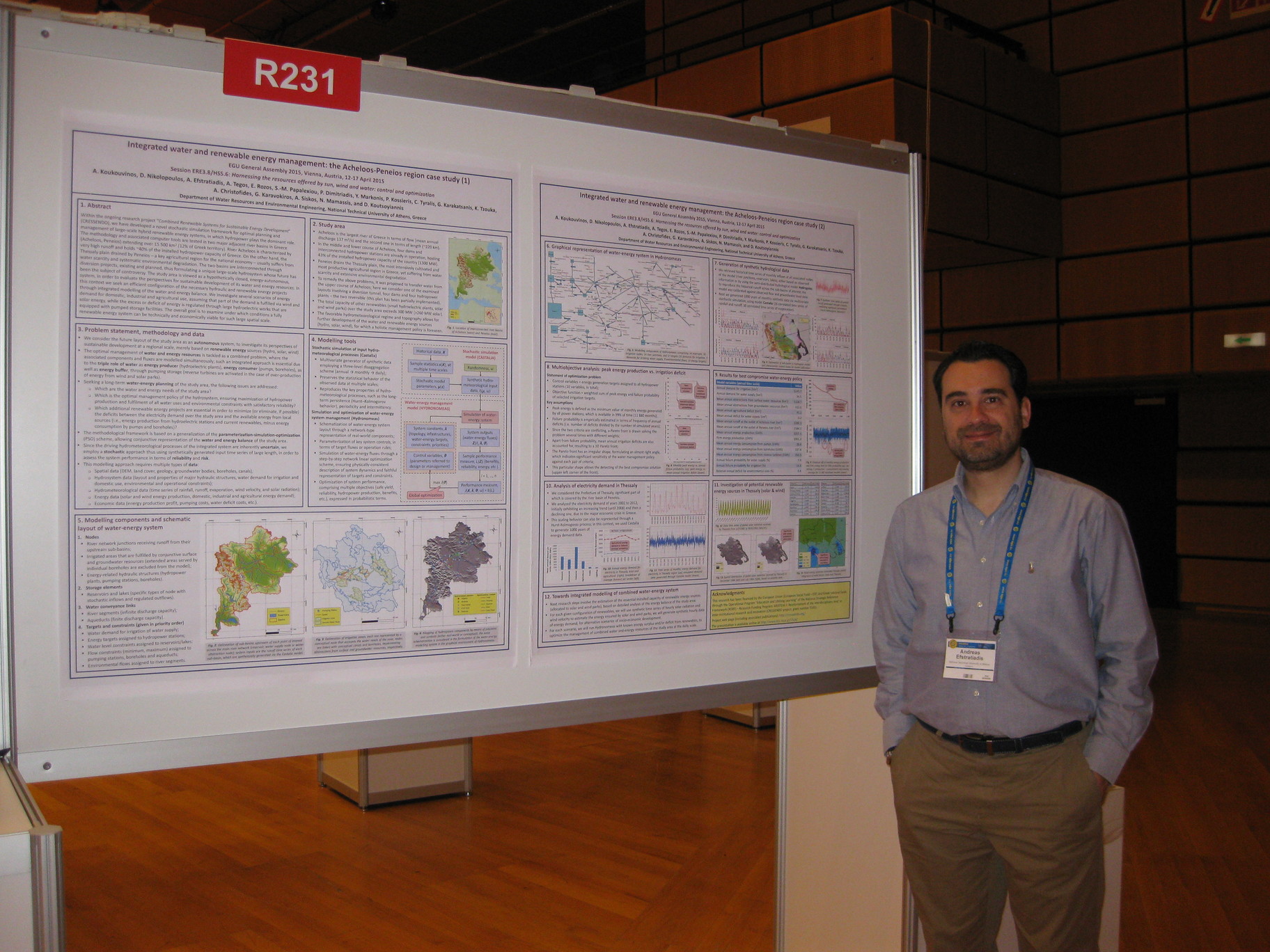